General Navigation
Exam Information
- Basics of Navigation: 28 Questions
- VFR Navigation: 7 Questions
- Great Circle and Rhumb Lines: 5 Questions
- Charts: 12 Questions
- Time: 3 Questions
- Total: 55 Questions | Duration: 2hr 15 mins
- Instructor: Matt Hall
NOTE
For the exam - bring the Jeppesen (big leather book). From October they’re going to stop printing the Jeppesen.
Conversion Factor: ==1 NM = 1.852 km==
The Geoid and Earth Models
The Geoid
A surface which defines zero elevation. This model is used to measure surface elevations with a high degree of accuracy.
The geoid is an irregular shape based on the surface of the oceans influenced only by gravity and centrifugal force.
WGS-84 (World Geodetic System)
A number of different ellipsoids are used to describe the shape of the Earth for mapping, but ==WGS-84 is the reference ellipsoid required for geographical coordinates.==
- ==Circumference of the Earth: Approximately 40,000 km or 21,600 NM==
- Geodetic latitude and longitude is used to define position on the WGS-84 ellipsoid
- 1984 is the year GPS/GNSS came in as the standard navigational reference system
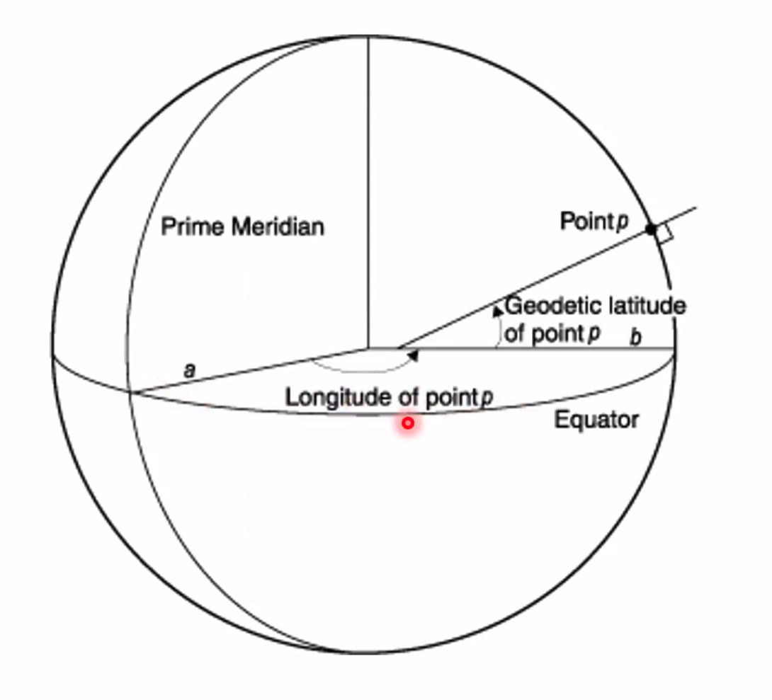
Geodetic Coordinates
Geodetic Latitude: The angle between the equatorial plane and the perpendicular line that intersects the normal (tangent) line at the point on the surface of the Earth.
Geodetic Longitude: The angle in the equatorial plane between the line that connects the Earth's centre with the prime meridian.
Meridians and Parallels
Meridians of Longitude
- Meridians run North to South
- Cross the equator at right angles
- ==Converge at the poles==
- ==Meridians together with anti-meridians are great circles==
- Are also Rhumb Lines
IMPORTANT
==Radio waves also follow great circles==
Parallels of Latitude
- Run West to East
- ==No convergence==
- All latitudes other than the equator are small circles and rhumb lines
- ==90 degrees N/S of equator==
Major Latitudes:
- Equator: 0°
- Tropic of Cancer: 23.5°N
- Tropic of Capricorn: 23.5°S
Q. Consider the positions (0°N/S 0°E/W) and (0°N/S 180°E/W) on the ellipsoid. Which statement about the distances between these positions is correct? A. The route via the north pole is shorter than the route along the equator
The route via the North or South pole will be shorter because of the geodetic shape of the Earth.
The Oblate Spheroid
==Ratio of ‘squishness’: 1/298==
Geocentric vs Geodetic Latitude
Geocentric Latitude:
- Determined around the center of the earth
- ==Unless specified, latitude used in aviation is geodetic latitude==
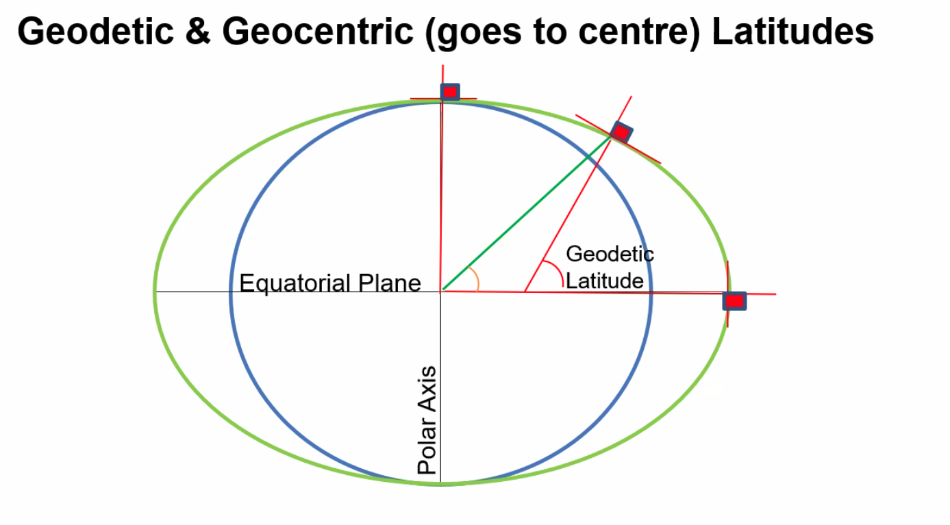
NOTE
==Greatest difference between geocentric and geodetic latitude is at 45°N/S==. Remember that aviation maps use geodetic latitude.
Q. Which figure in the diagram represents the geocentric latitude of position P, which is situated above the surface of the ellipsoid?
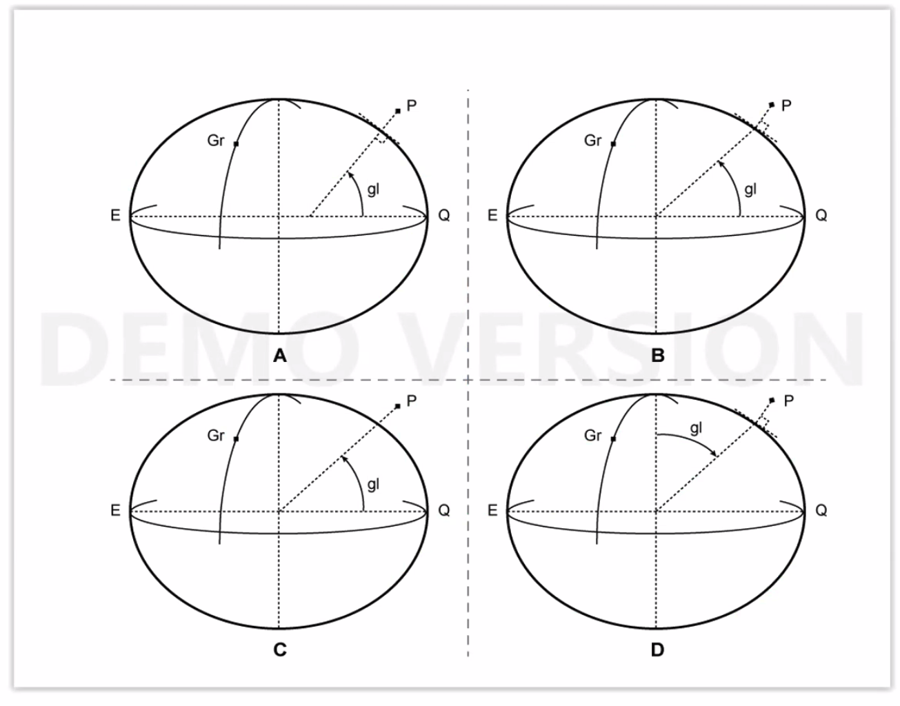
A. It’s B, because we measure at 90 degrees/right angles on the surface of the Earth but the line going into the earth then needs to go to the centre of the earth.
Distance Measurements
Longitude Distance
==1 degree of Longitude along the equator = 60 NM==
Latitude Distance
==1 degree of latitude along a meridian:==
- ==At the equator: 59.7 NM==
- ==At 45°N/S: 60 NM==
- ==At 90°N/S: 60.3 NM==
Great Circles and Vertices
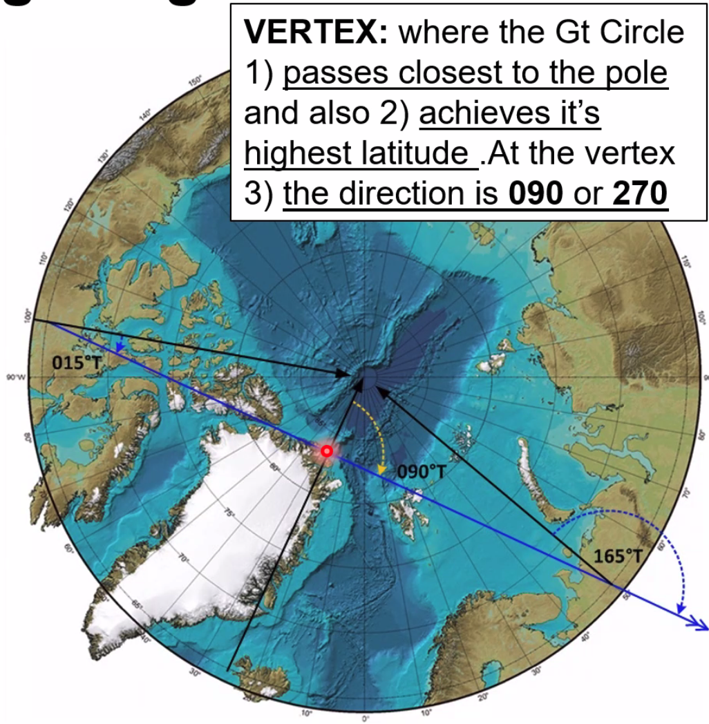
Vertex
==The vertex is where the great circle:==
- Passes closest to the pole, AND
- Achieves its highest latitude
- ==At the vertex, the direction is 090° or 270°==
NOTE
Magnetic North Pole and Magnetic South Pole are not opposite each other - they are not antipodal.
Magnetism and Compass Navigation
Key Definitions
Declination (Variation): Deviation of the compass from true north
Isogonal: A line joining points of equal magnetic variation (not structured like Latitude & Longitude)
Agonic Line: Line of zero variation (shown as black lines on charts)
Compass North: The north of each aircraft, based on the alignment of the aircraft’s magnetism (Deviation)
Compass Swing Requirements
A compass swing may be required when:
- Parked in the same direction for too long of a period
- When specified in the aircraft maintenance schedule
- New compass is fitted
Compass Calculations
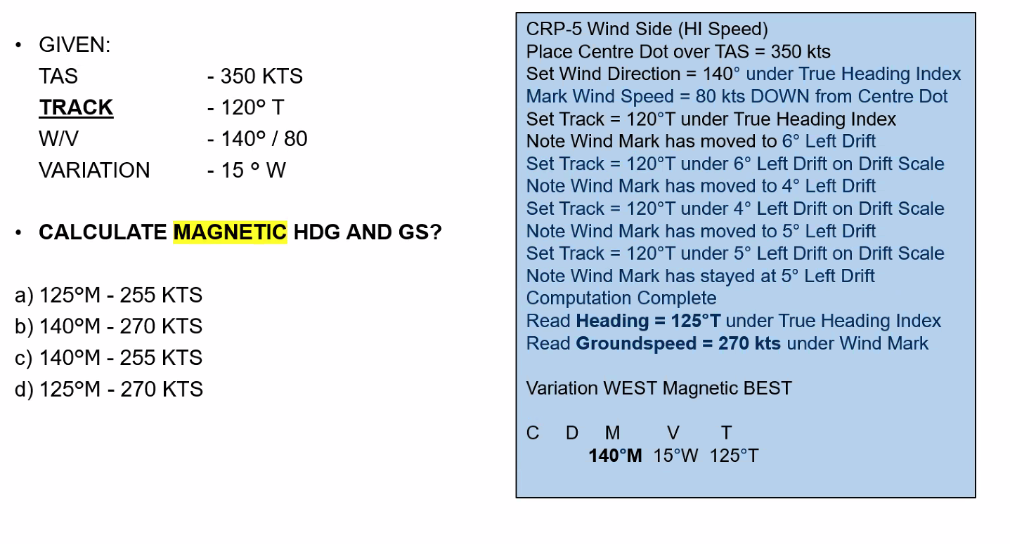
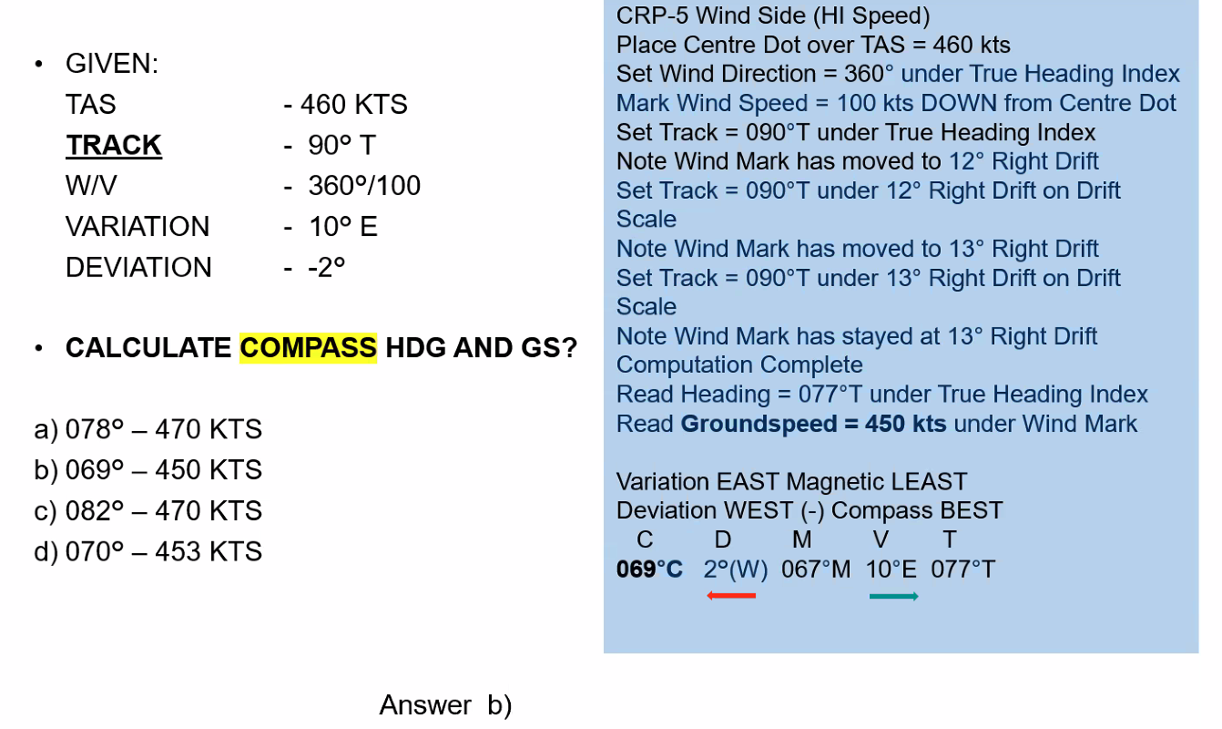
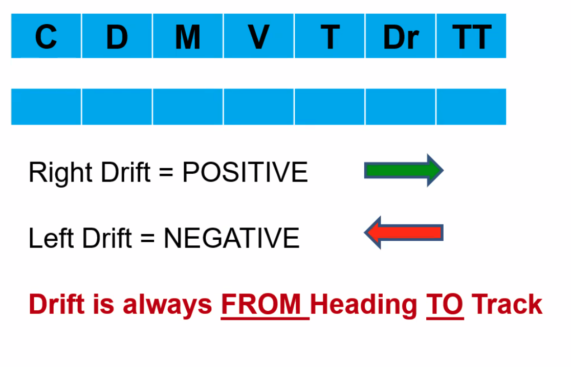
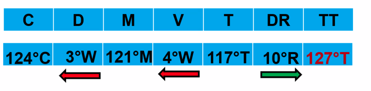
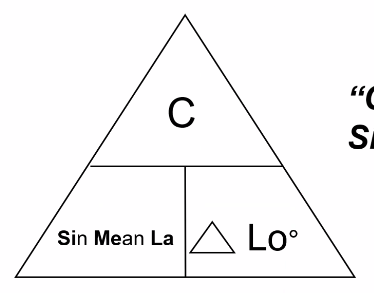
Mnemonic: ==Cadbury’s Dairy Milk Very Tasty==
C D M V T (Compass → Deviation → Magnetic → Variation → True)
Q. If the compass heading is 265°, variation is 33°W and deviation is 3°E, what is the true heading? A. 235°
Q. Given true track is 348°, drift is 17°L, variation is 32°W, deviation is +4°. What is the compass heading? A. 033°C
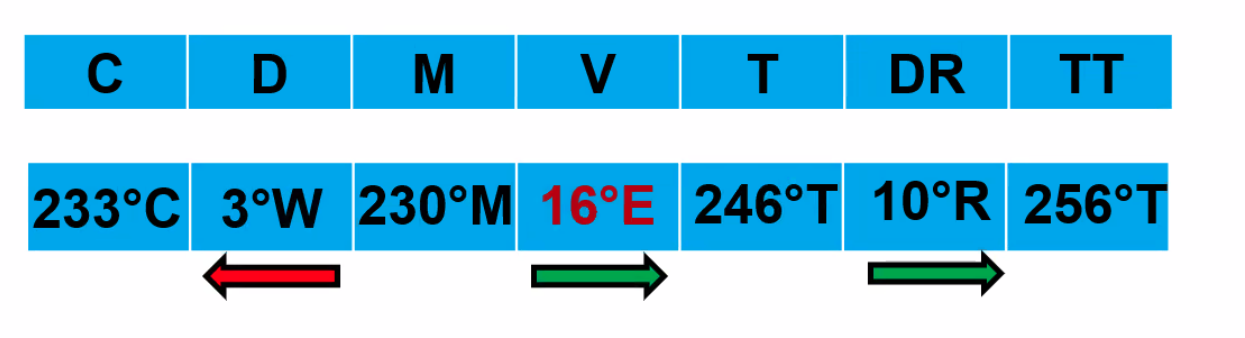
Q. Given compass heading = 233°, true track = 256°, drift angle = 10°R, deviation = -3°. What is the variation? A. 16°E
Q. Given compass heading = 124°, deviation = -3°, variation = 4°W. What is the true track given 10° starboard drift? A. 127°
Change of Latitude and Longitude
Q. What is the change in latitude between N62°15’ E121°50’ and N33°55’ E121°50’? A. 28°20' OR 1,700 NM
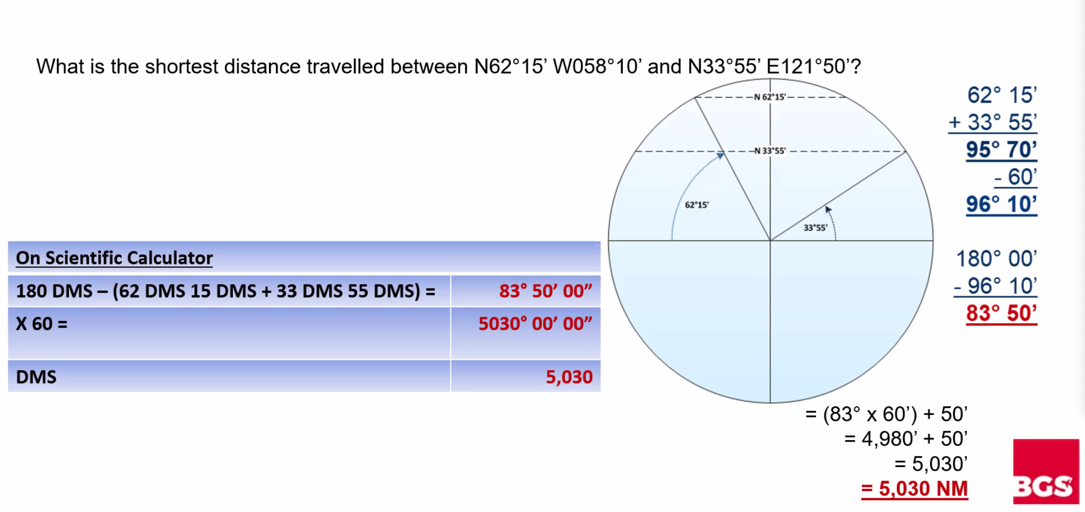
Q. What is the shortest distance travelled between N62°15’ W058°10’ and N33°55’ E121°50’? A. 83°50' OR 5,030 NM (because the longitudes equal 180° it is shorter to go over the poles)
Departure Distance
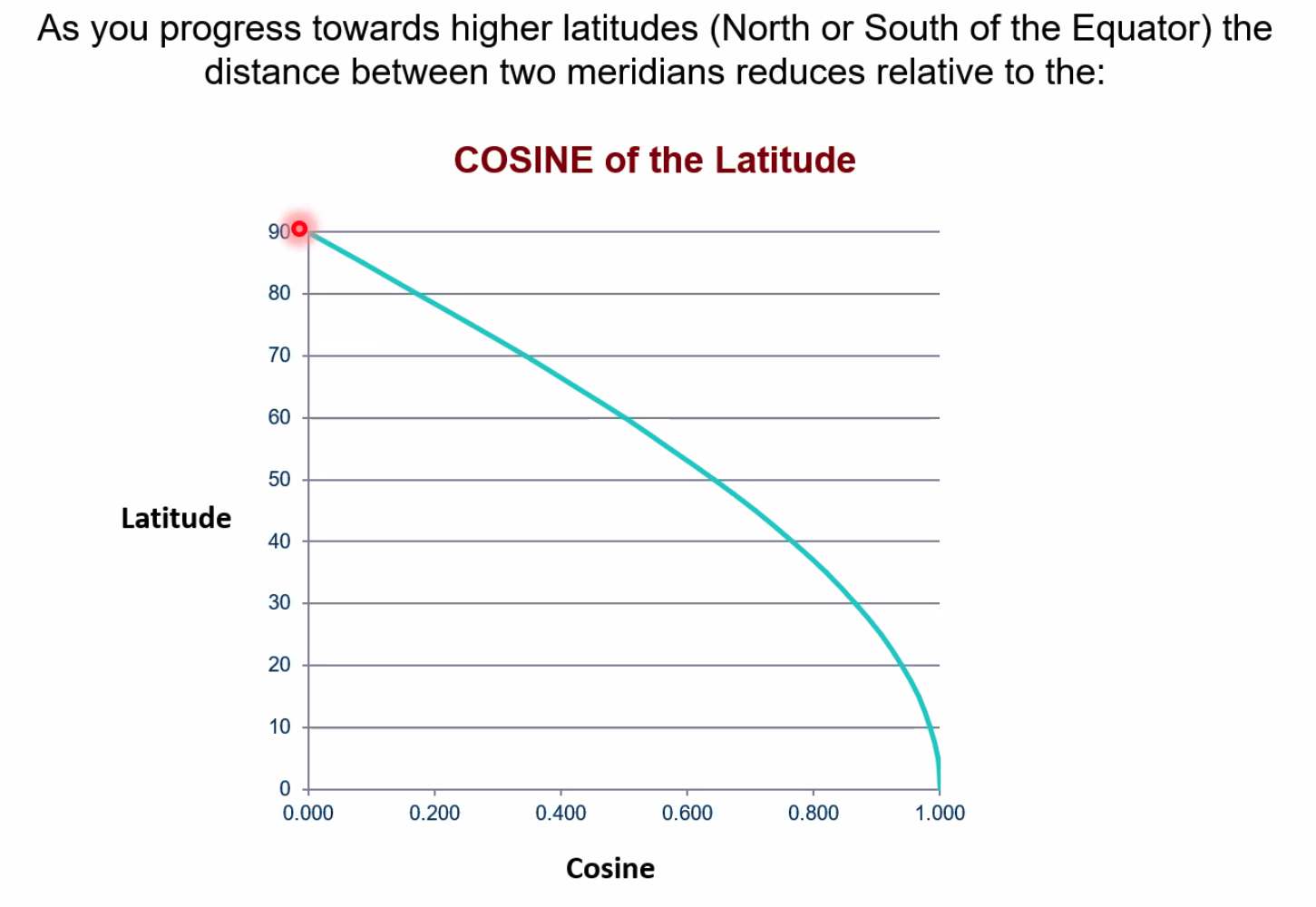
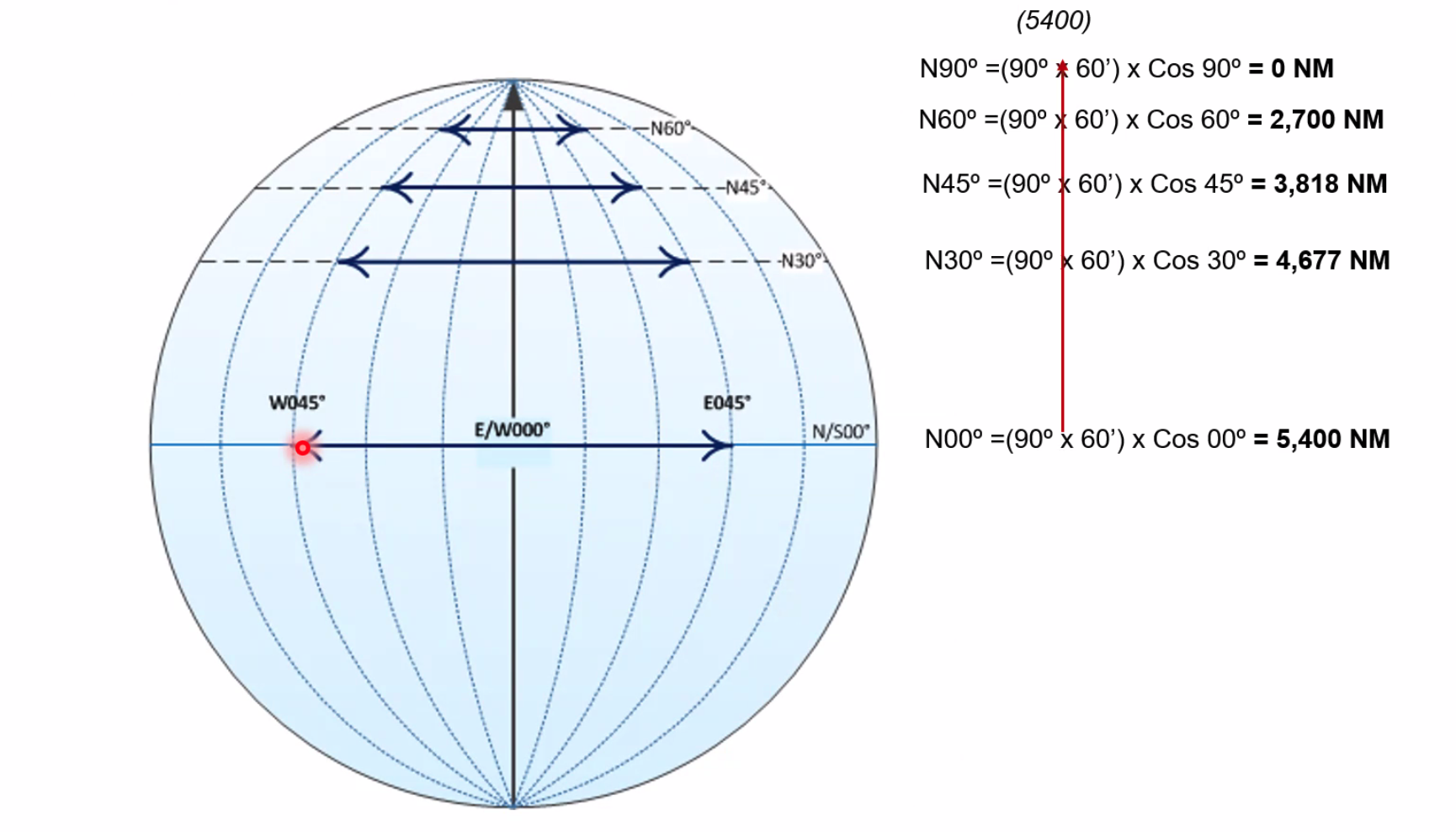
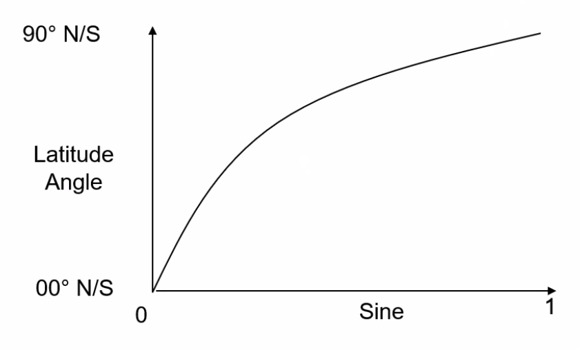
==The lateral difference (distance) along a parallel of latitude differs depending on the latitude, reducing relative to the COSINE of the latitude.==
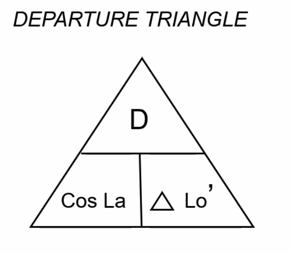
Departure Formula
IMPORTANT
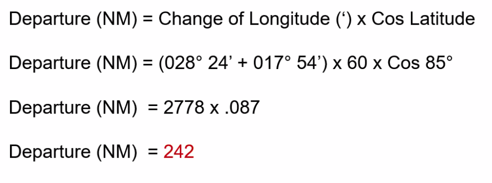
==Departure (NM) = Change of Longitude (’) × Cos(Latitude)==
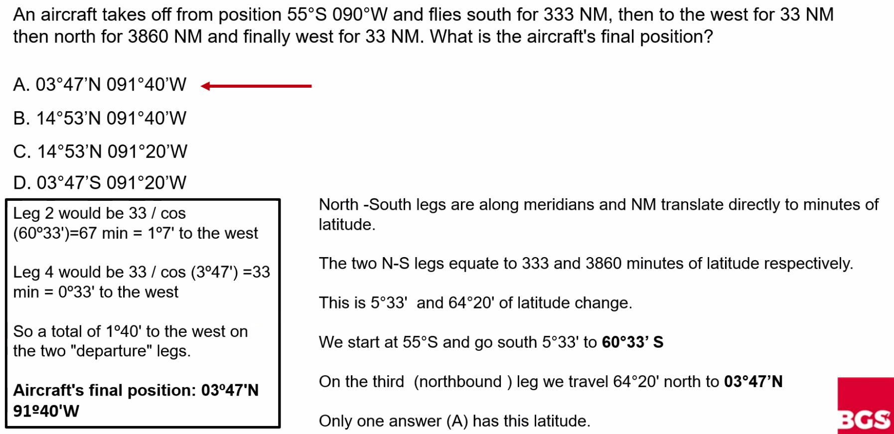
Example Problems
Q. An aircraft at position 60°N 005°W tracks 090°T for 315 km. On completion of the flight the longitude will be:
Solution:
- Departure = 315 km OR 170 NM
- Cos(60°) = 0.5
- Longitude (in minutes) = Departure / Cos(Lat)
- Longitude (in mins) = 170 NM / 0.5 = 340’
- Longitude (in degrees) = 340’ / 60 = 5°40’
- 5°W - 5°40’ = 0°40’E
A. 0°40'E
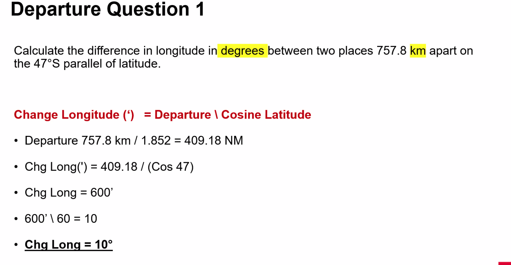
Q. An aircraft departs N45°, E/W 0° and flies due south for 3,300 NM, then flies due east for 2,700 NM, due north for 2,100 NM and finally due west for 3,300 NM. What is its final position? (Round to nearest whole minute) A. N25° W15°
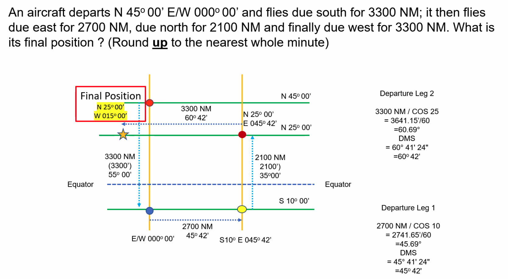
Q. An aircraft takes off from position 55°S 090°W and flies south for 333 NM, then to the west for 33 NM, then north for 3,860 NM and finally west for 33 NM. What is the aircraft’s final position?
Q. Consider the distance between any two geodetic lines of longitude (meridians) separated by 10° on the surface of the Earth ellipsoid. The distance between the meridians, when measured at the same latitude… A. Remains constant for a given change in longitude
Q. The distance in NM between point A (85°N 028°24’W) and B (85°N 017°54’E) is: A. 242 NM
Rhumb Lines vs Great Circles
Key Relationship
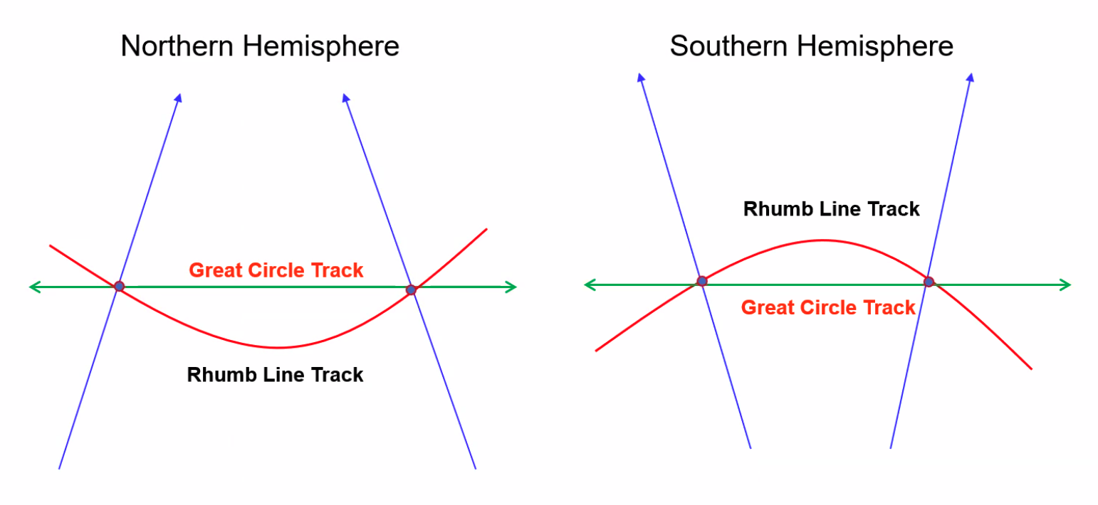
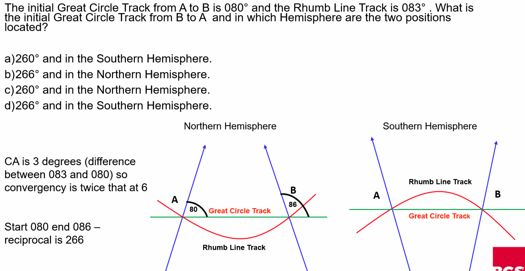
==Rhumb Lines lie on the equatorial side of Great Circle Track==
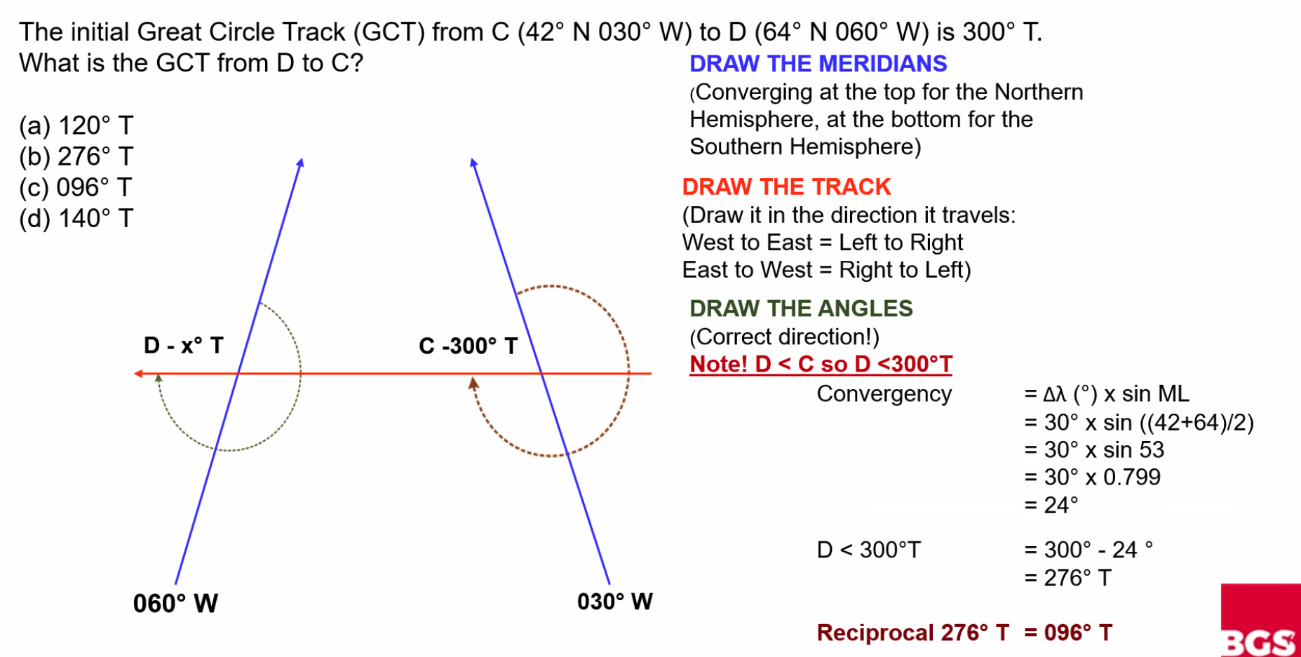
Convergency
Convergency Formula
IMPORTANT
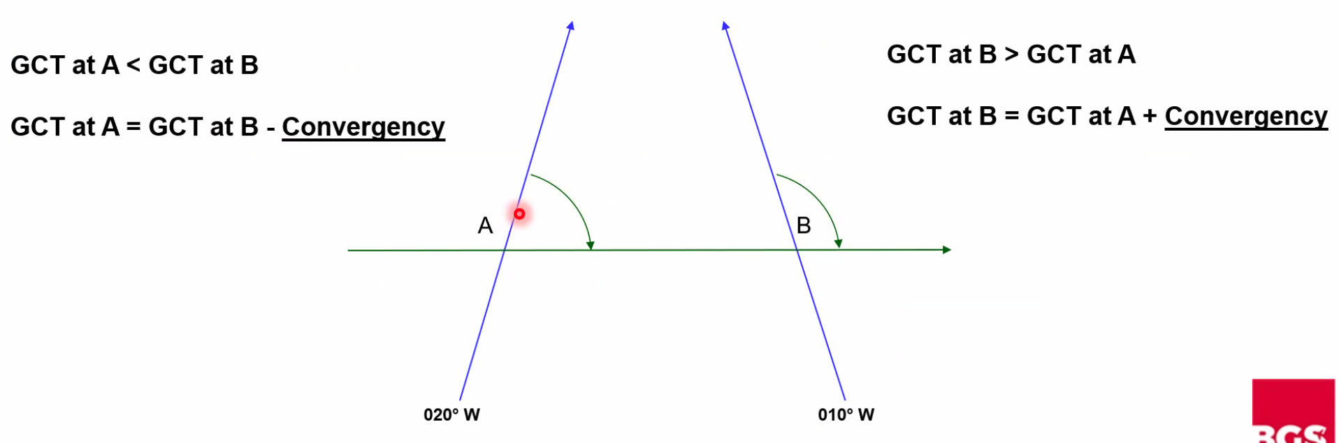
==Convergency is the difference between the two great circle tracks==
DIDI Diagram
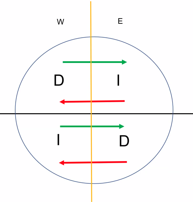
Q. An aircraft follows a great circle in the Northern Hemisphere. As the aircraft continues beyond the point where the track is 270°T, the great circle track angle will: A. Decrease and the latitude will decrease
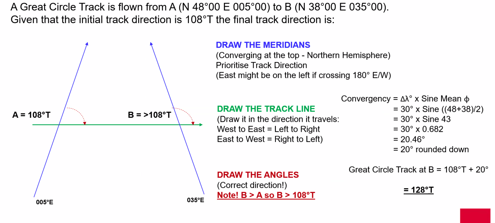
Q. A great circle track is flown from A (N48° E005°) to B (N38° E35°). Given that the initial track direction is 108°T, the final track direction is: A. 128°T
Loxodrome and Orthodrome
Loxodrome: A line on a surface that cuts all meridians at a constant angle (but not a right angle) - also known as a Rhumb Line
Orthodrome: A great circle
Conversion Angle
==Conversion Angle (CA) = ½ Convergency==
Conversion Angle is the difference between the GCT (Great Circle Track) and the RLT (Rhumb Line Track) at the start and finish point.
Q. The great circle track measured at A (45°N 10°W) from A to B (45°N 019°W) is approximately: A. 273°
NOTE
Over short distances and out of polar regions, the average great-circle true track is approximately equal to the rhumb line true track between two points.
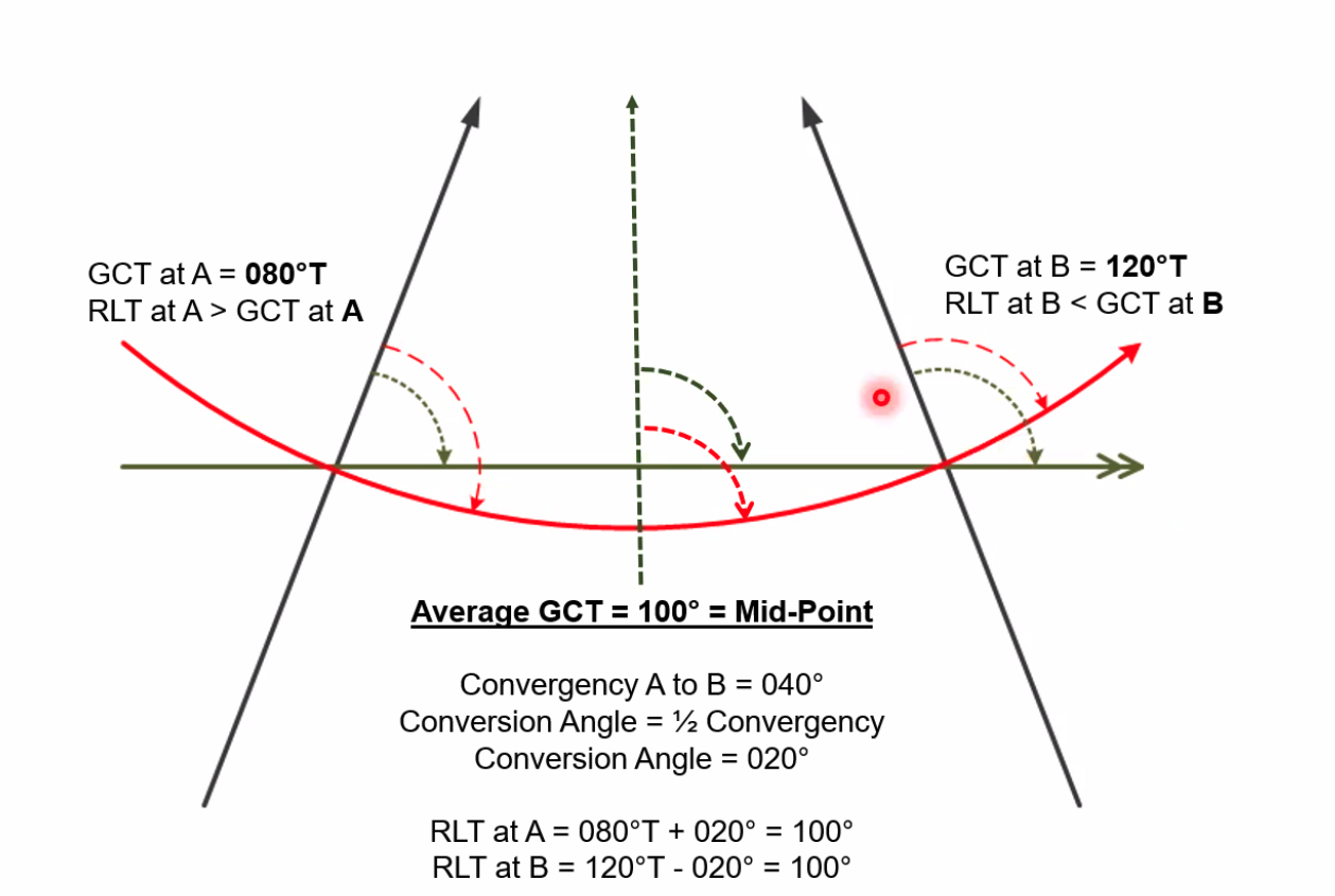
Average Great Circle Track
==Average GCT = Mid Point==
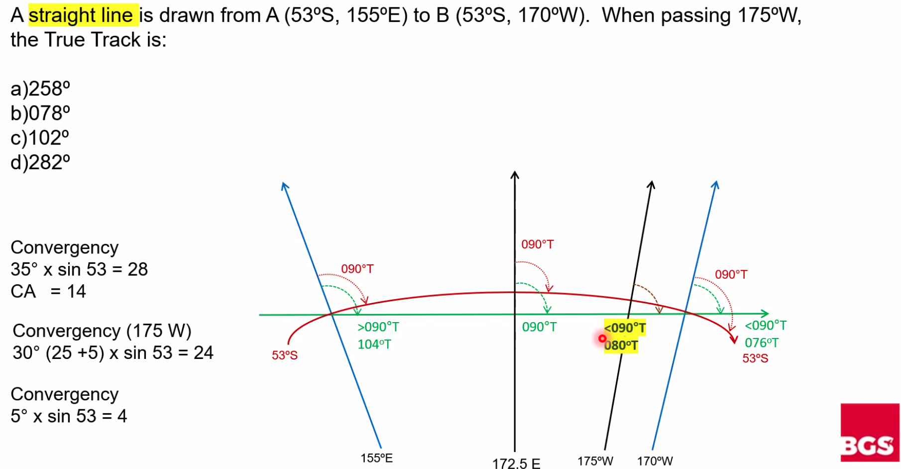
Q. A straight line is drawn from A (53°S 155°E) to B (53°S 170°W). When passing 175°W, the true track is: A. 078°
Maps & Charts
WARNING
==Flat maps lie and maps lie flat==
Map Distortion Types
Maps can preserve different properties, but not all at once:
- Shape (Conformal/Orthomorphic): Preserves angles and shapes locally
- Area: Size of a feature on a map is the same relative to its size on Earth
- Distance (Equidistant): Preserves true scale for all straight lines passing through a single, specified point
- Direction: If the direction/azimuth from A to B is the same on a map as on Earth
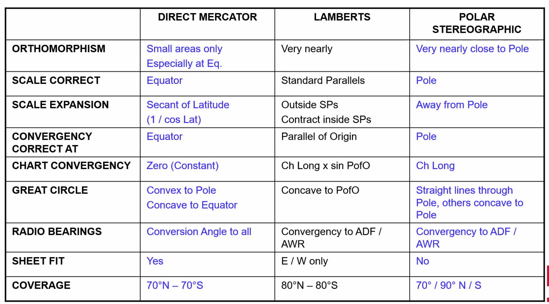
Chart Projection Types
Direct Mercator:
- Meridians are parallel lines
- ==Convergency is zero==
- Only correct at the equator
- Constant over the whole chart
Lambert’s Conformal:
- Meridians are converging
- Shown as straight lines
- Rate of convergence is constant
- ==Correct at the parallel of origin==
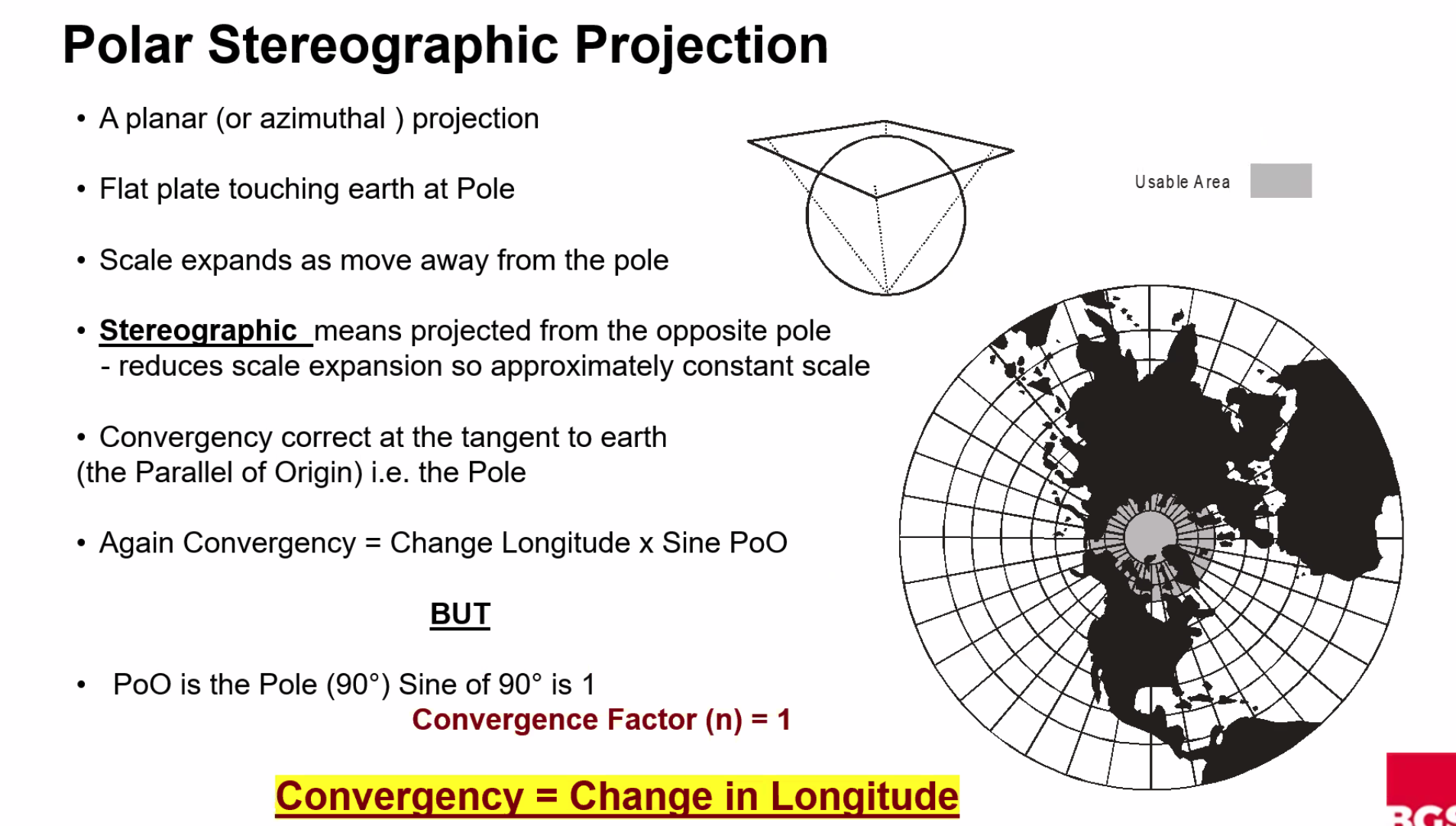
Polar Stereographic:
- Meridians are straight lines which meet at the pole
- ==Convergency is constant==
IMPORTANT
==A conformal projection on which a straight line approximates a great circle should be used.==
Conformal or orthomorphic map/chart projections preserve angles locally.
Chart Scale
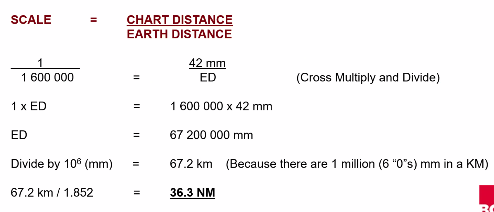
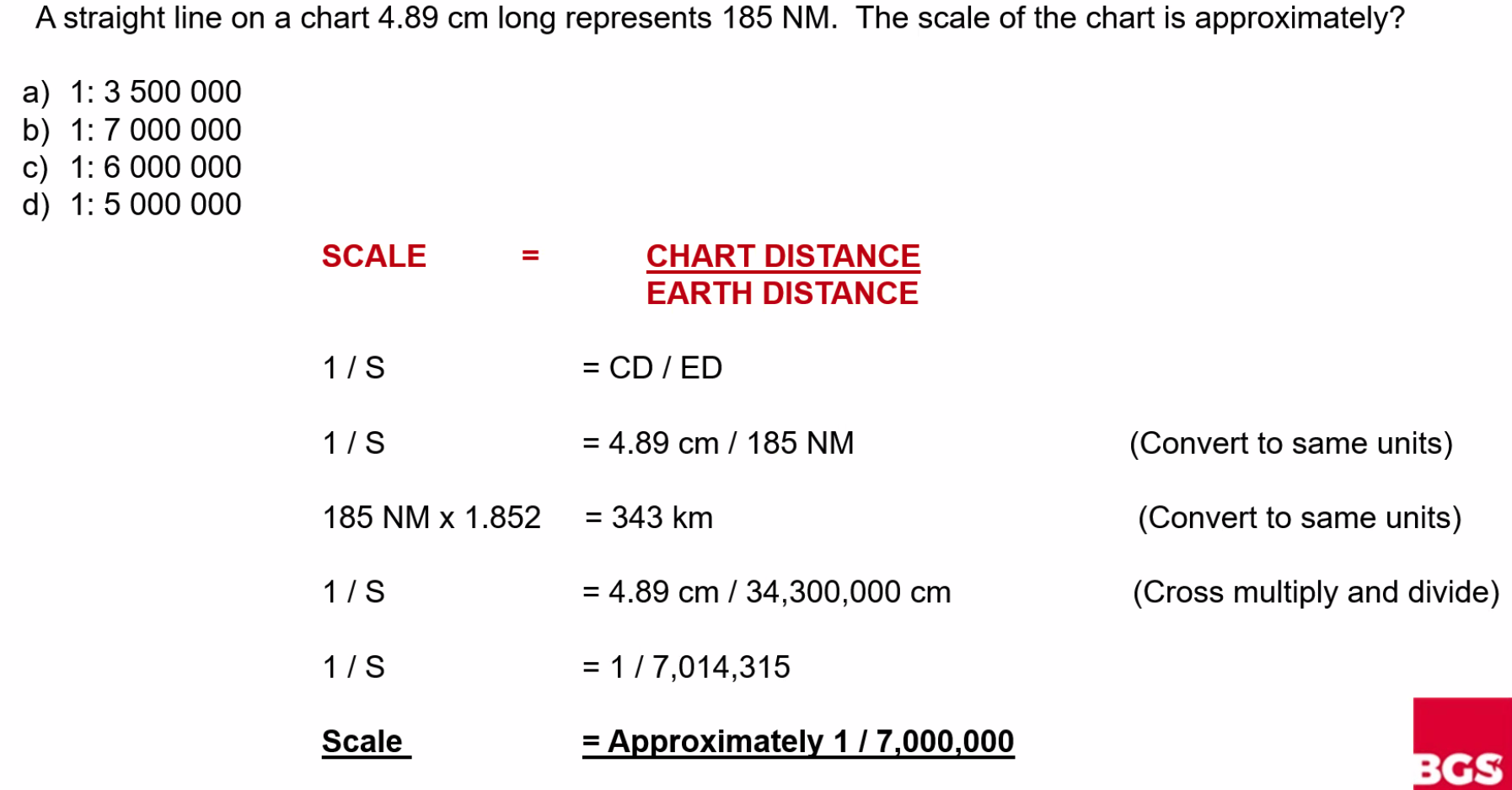
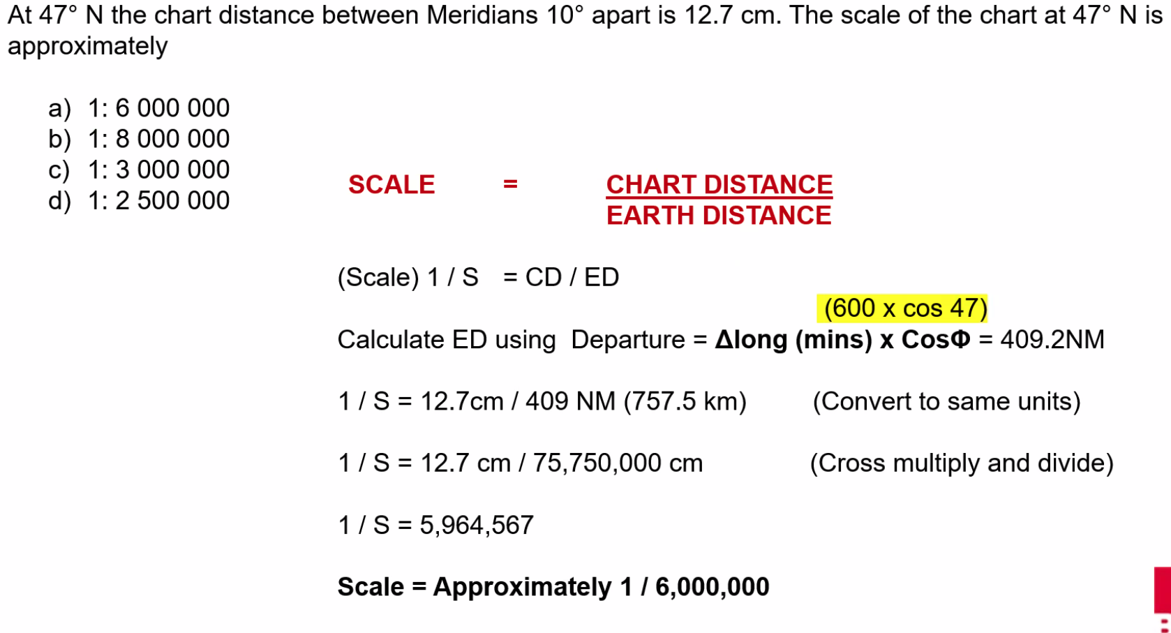
==Scale = Chart Distance / Earth Distance==
Scale Problems
Q. The distance measured between two points on a navigation chart is 42 mm. The scale of the chart is 1:1,600,000. The actual distance (in NM) between these two points is approximately: A. 36.3 NM
Q. A straight line on a chart 4.89 cm long represents 185 NM. The scale of the chart is approximately: A. 1:7,000,000
Q. At 47°N the chart distance between Meridians 10° apart is 12.7 cm. The scale of the chart at 47°N is approximately: A. 1:6,000,000
Understanding Scale
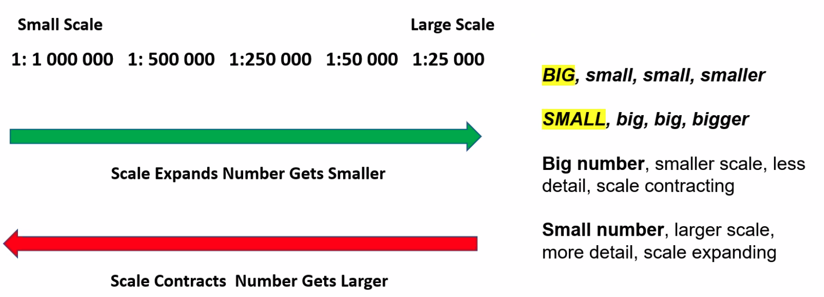
- ==As a scale expands it gets larger and large scale charts have a larger amount of detail==
- ==As a scale contracts it gets smaller and small scale charts have a smaller amount of detail==
- ==As a scale expands the number in the fraction or ratio gets smaller==
Q. Determine the two smallest maps, given the following:
- A. 1:500,000
- B. 10 cm = 10 NM / 1:185,200
- C. 5 inch = 10 NM / 1:145,826
- D. 1:110,000
A. A & B
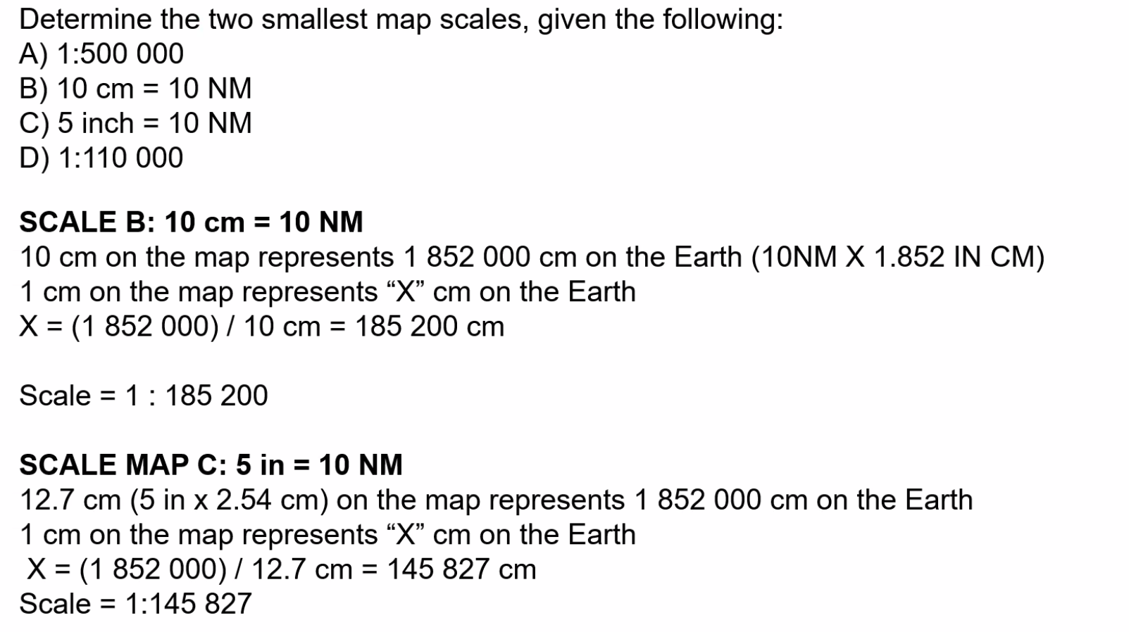
Chart Projection Analysis
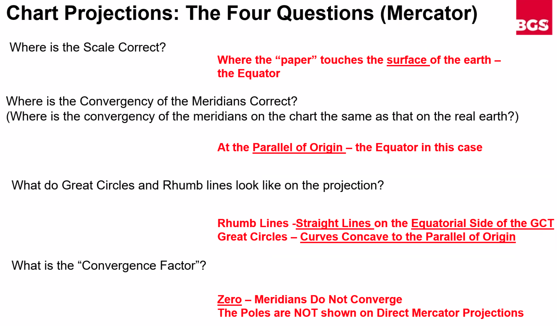
Four Key Questions
- Where is the scale correct?
- Where is the convergency of the meridians correct? (Where is the convergency on the chart the same as on the real Earth?)
- What do great circles and rhumb lines look like on the projection?
- What is the convergency factor?
Orthomorphic: Correct Shape Conformal: Having Shape
Mercator Projection
Q. An aircraft is tracking the 105° radial inbound to a VOR in the Northern Hemisphere. The magnetic variation is 4°E at the aircraft’s position and 8°E at the VOR. The earth convergency between the aircraft’s position and the VOR is 6°E.
To plot a straight line from the VOR to the aircraft on a Direct Mercator chart, what true course from the VOR should be plotted?
A. 113°
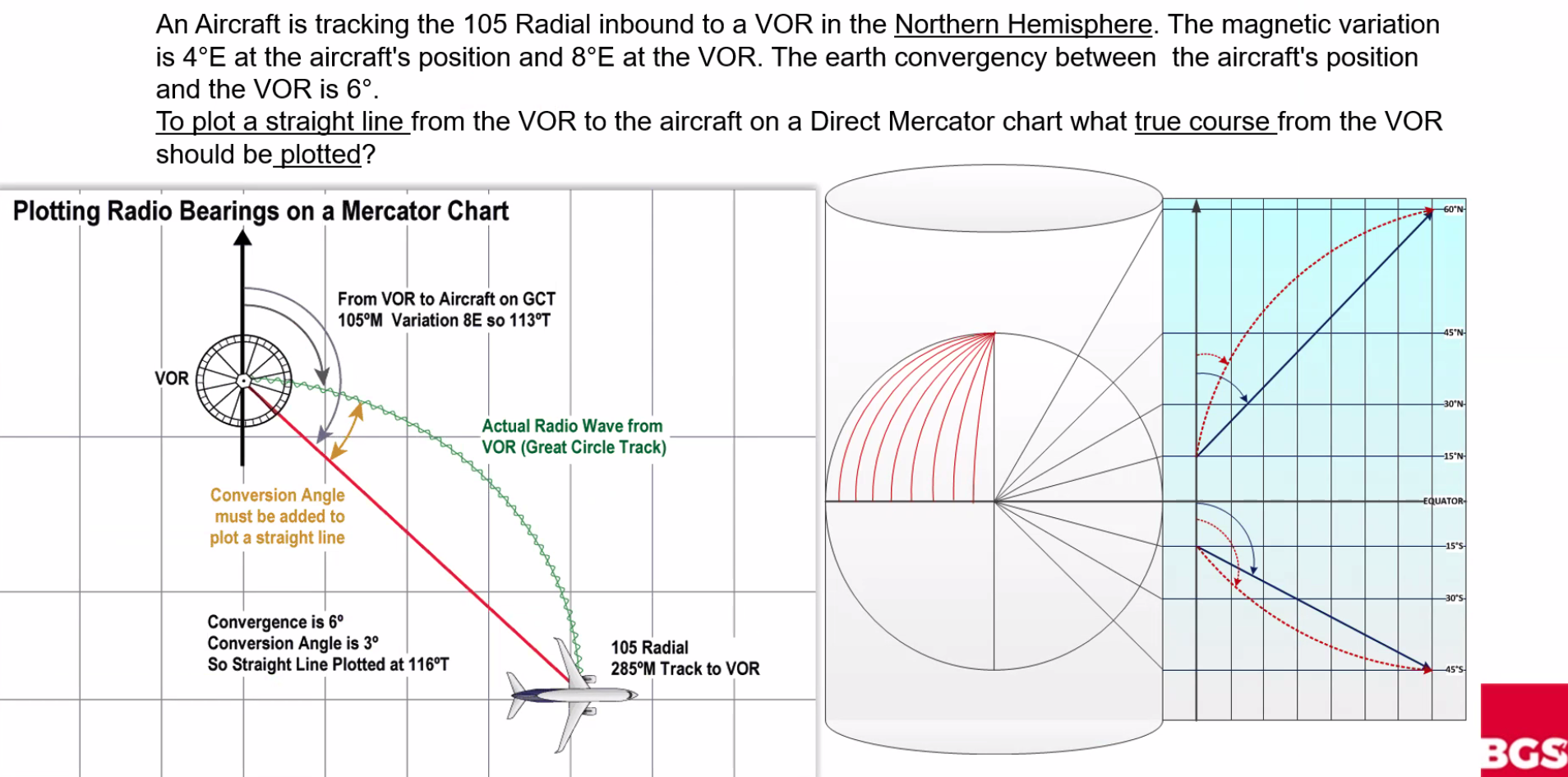
We know that the radio wave is a GCT, and we are plotting a straight line from the VOR to the aircraft. 105°M + 8°E variation = 113°T
Mercator Scale Problems
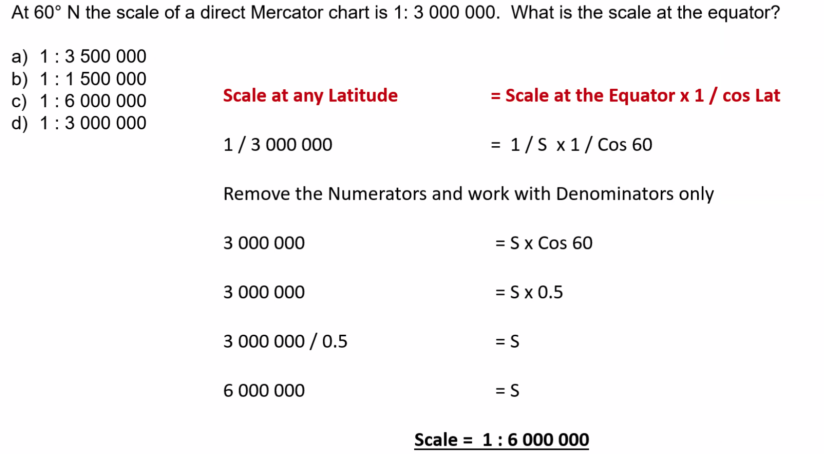
Q. At 60°N the scale of a direct Mercator chart is 1:3,000,000. What is the scale at the equator? A. ==Scale = 1:6,000,000==
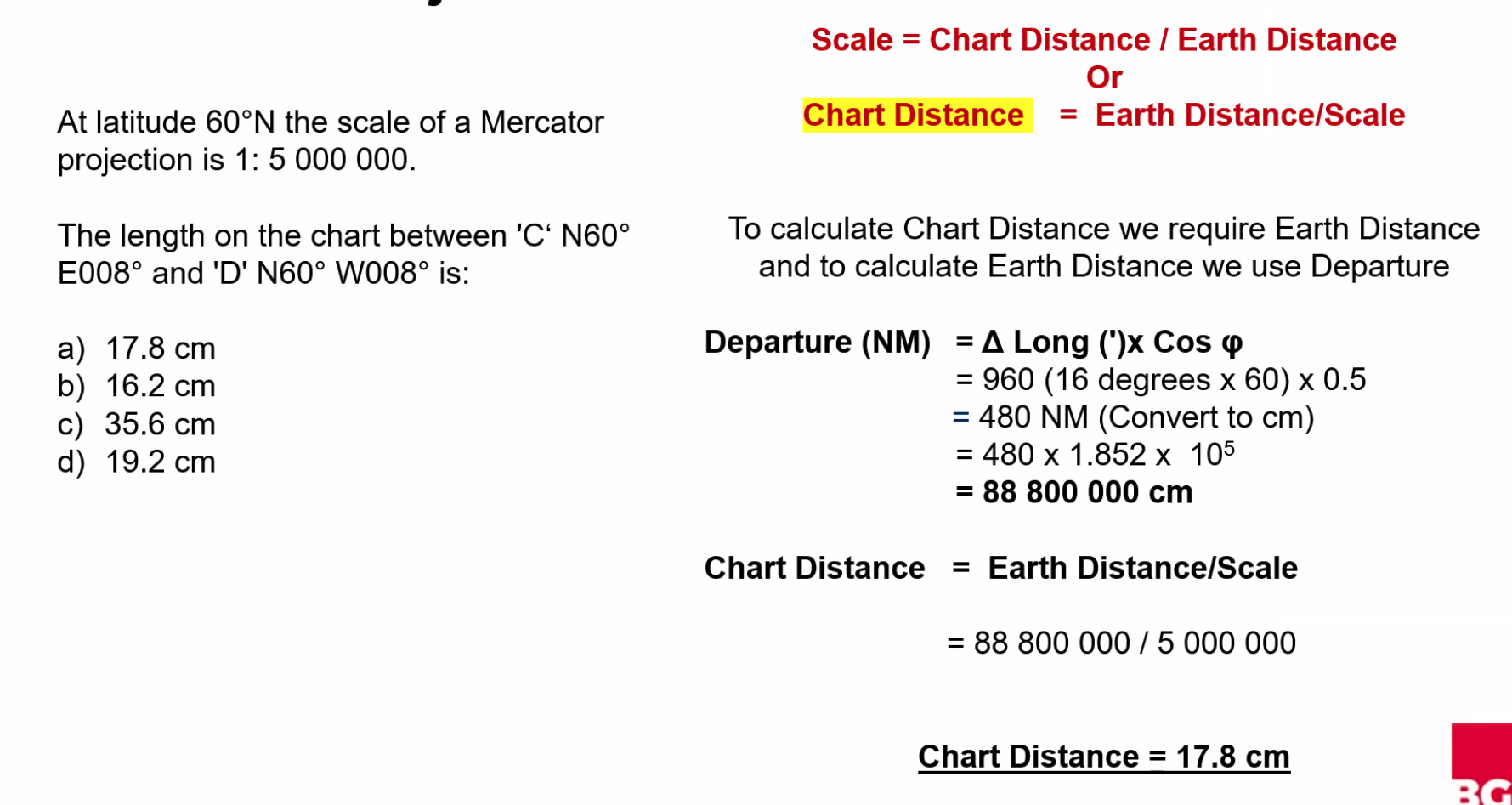
Q. At latitude 60°N the scale of a Mercator projection is 1:5,000,000. The length on the chart between C (N60° E008°) and D (N60° W008°) is: A. 17.8 cm
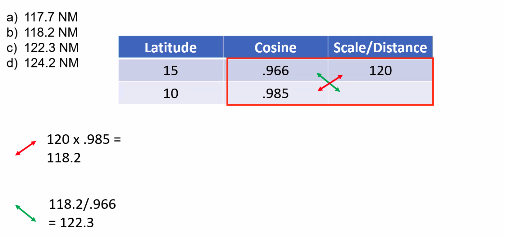
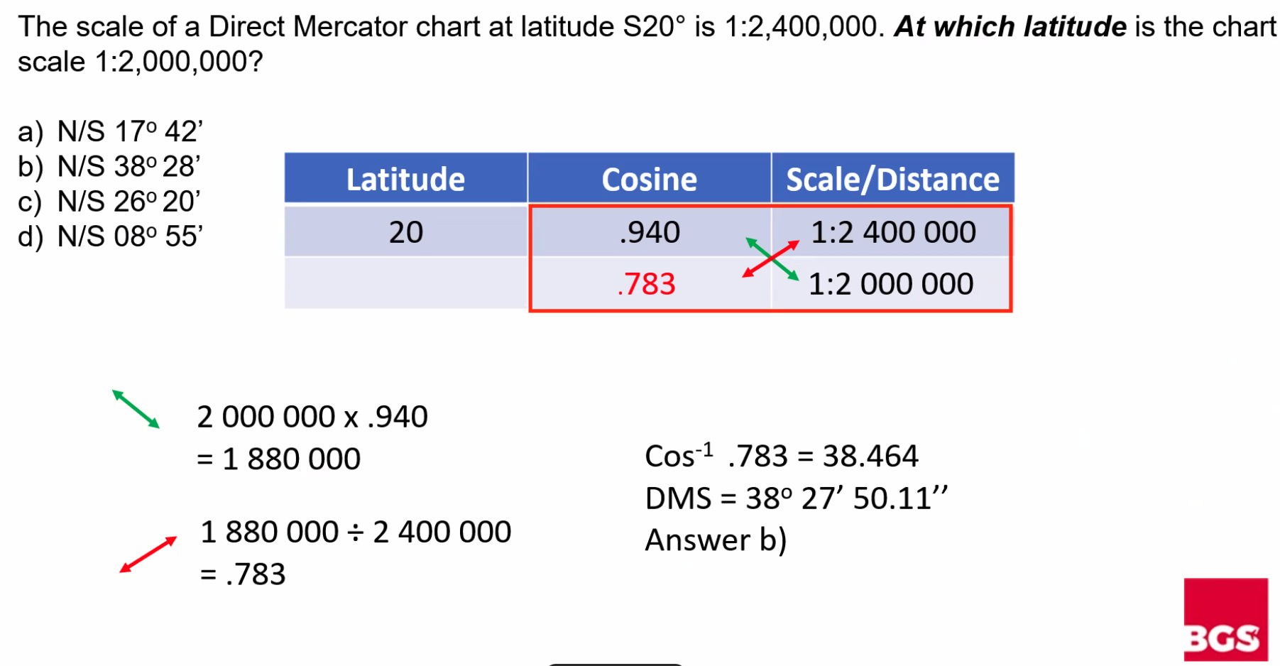
Q. On a Direct Mercator chart at latitude 15°S a certain length represents a distance of 120 NM on the earth. The same length on the chart will represent on the earth, at latitude 10°N a distance of: A. 122.3 NM
ABBA Formula
IMPORTANT
==Earth Distance Lat A × Cos(Lat B) = Earth Distance Lat B × Cos(Lat A)==
Q. The scale of a direct Mercator chart at latitude N30° is 1:2,500,000. What is the chart scale at N45°? A. 1:2,040,000
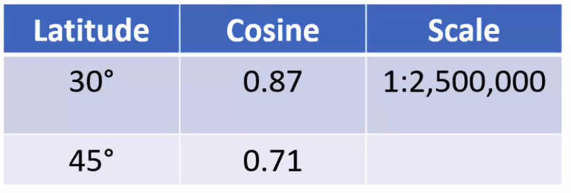
NOTE
==Latitude is increasing from N30° to N45°, therefore scale is expanding. As scale expands the number reduces!==
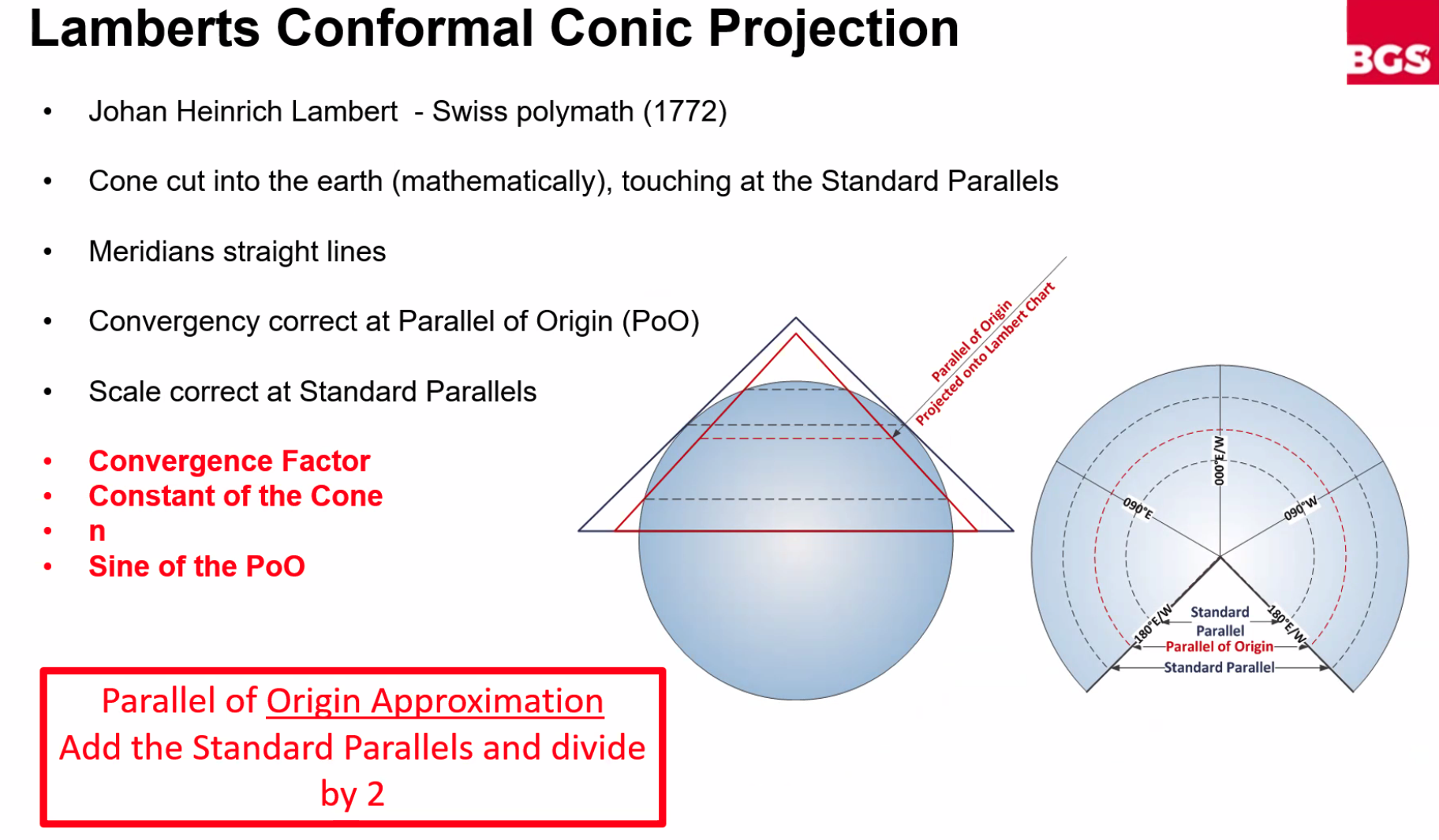
Lambert’s Conformal Projection
Scale Characteristics
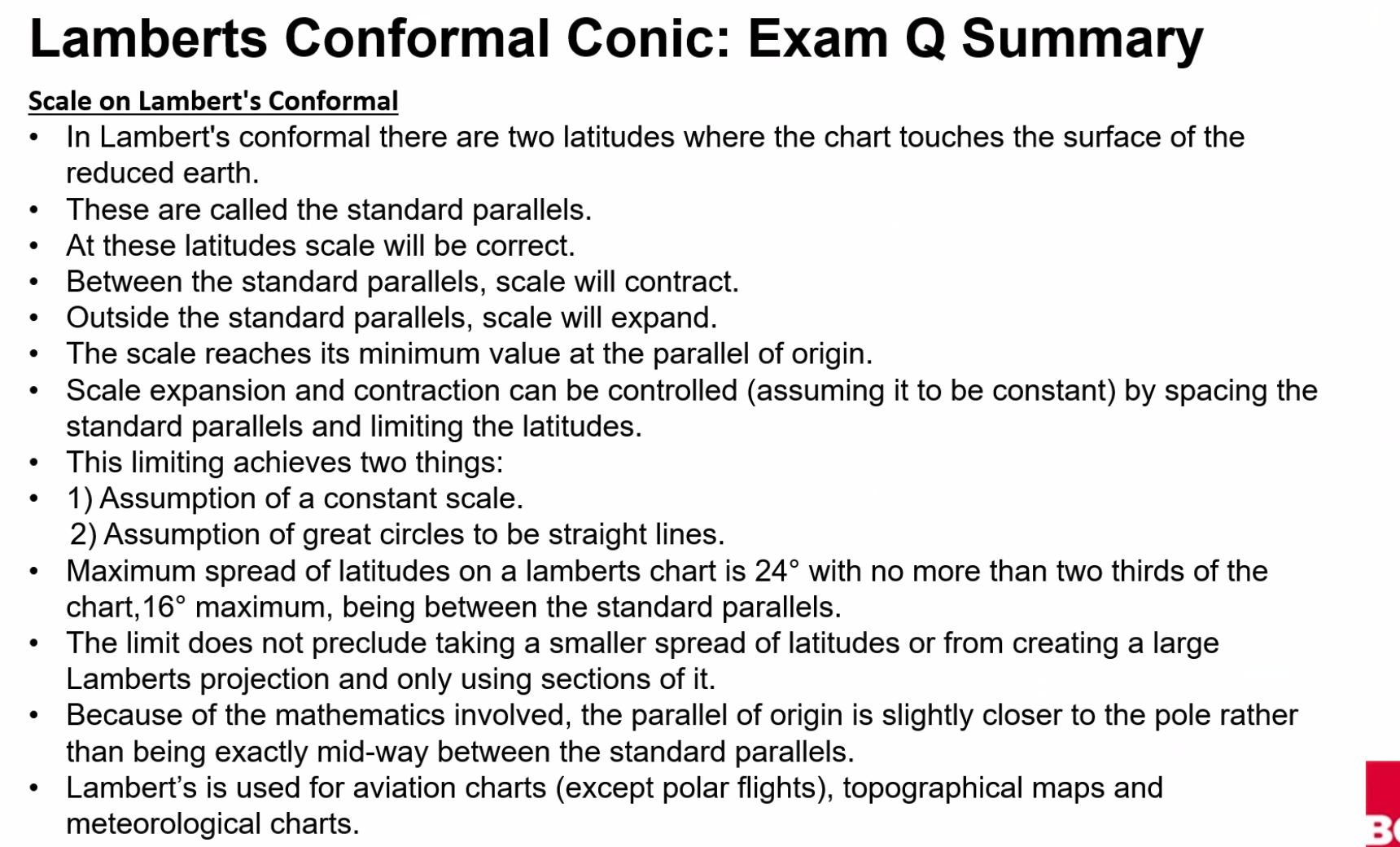
- ==Scale is CORRECT at the Standard Parallels==
- ==Scale contracts between the Standard Parallels==
- ==Scale expands outside the Standard Parallels==
Chart Coverage
==Ideal maximum spread of latitudes on a Lambert chart is 24° with no more than two-thirds of the chart (16° max)==
Parallel of Origin
At the Parallel of Origin:
- ==Chart convergency = Earth convergency==
- ==Scale = Minimum value==
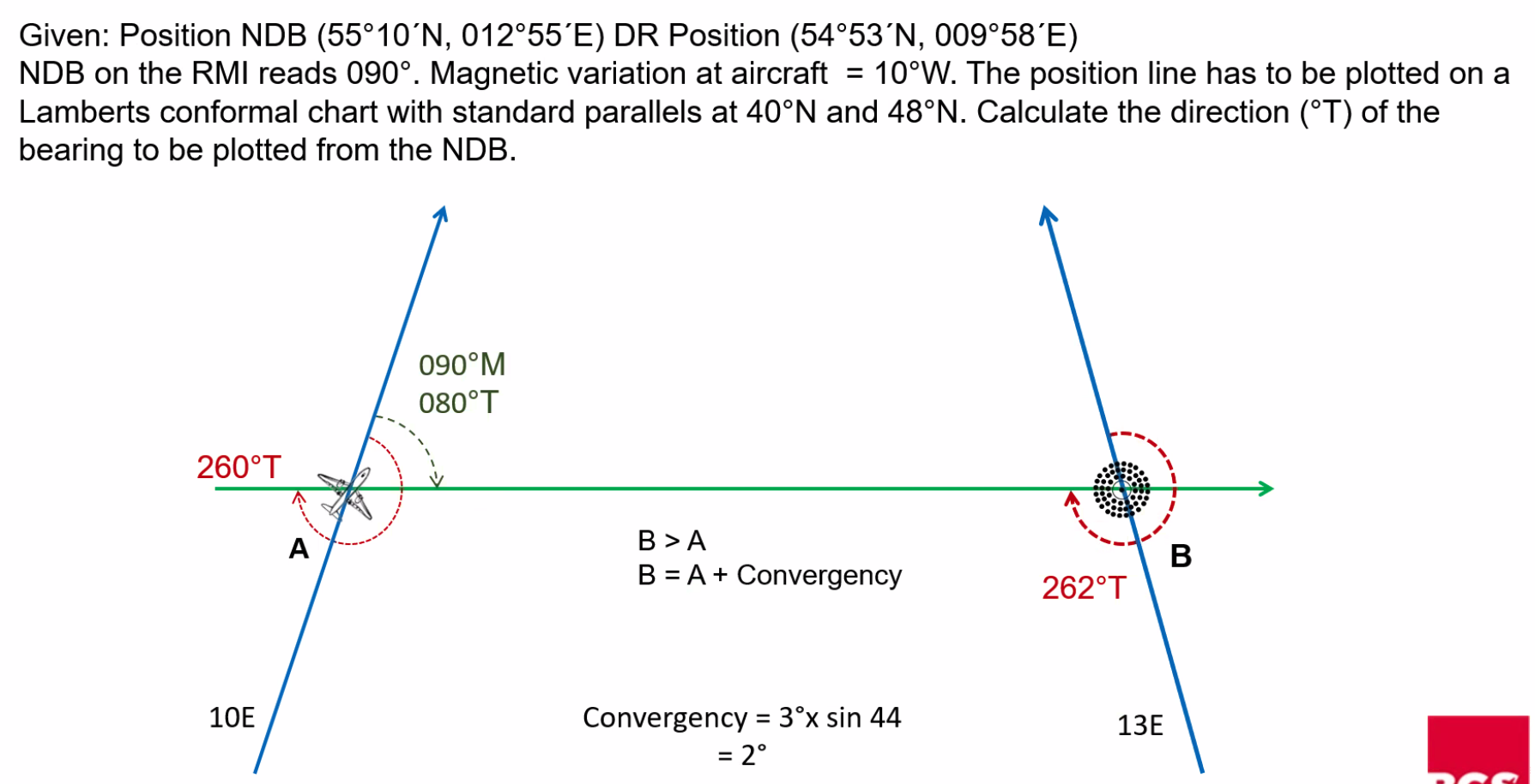
VOR vs NDB Bearings
- VOR Bearings: Measured at the ground station
- NDB Bearings: Measured at the aircraft by ADF Equipment
- ==Will need to apply convergency to plot NDB bearings onto a chart==
Lambert Projection - Key Questions
Q. Where is the scale correct? A. ==Where the paper touches the surface of the earth - at the Standard Parallels==
Q. Where is the convergency of the Meridians correct? A. ==At the Parallel of Origin==
Q. What is the convergence factor? A. ==At the sine of the parallel of origin==
Q. What do Great Circles and Rhumb lines look like on the projection? A.
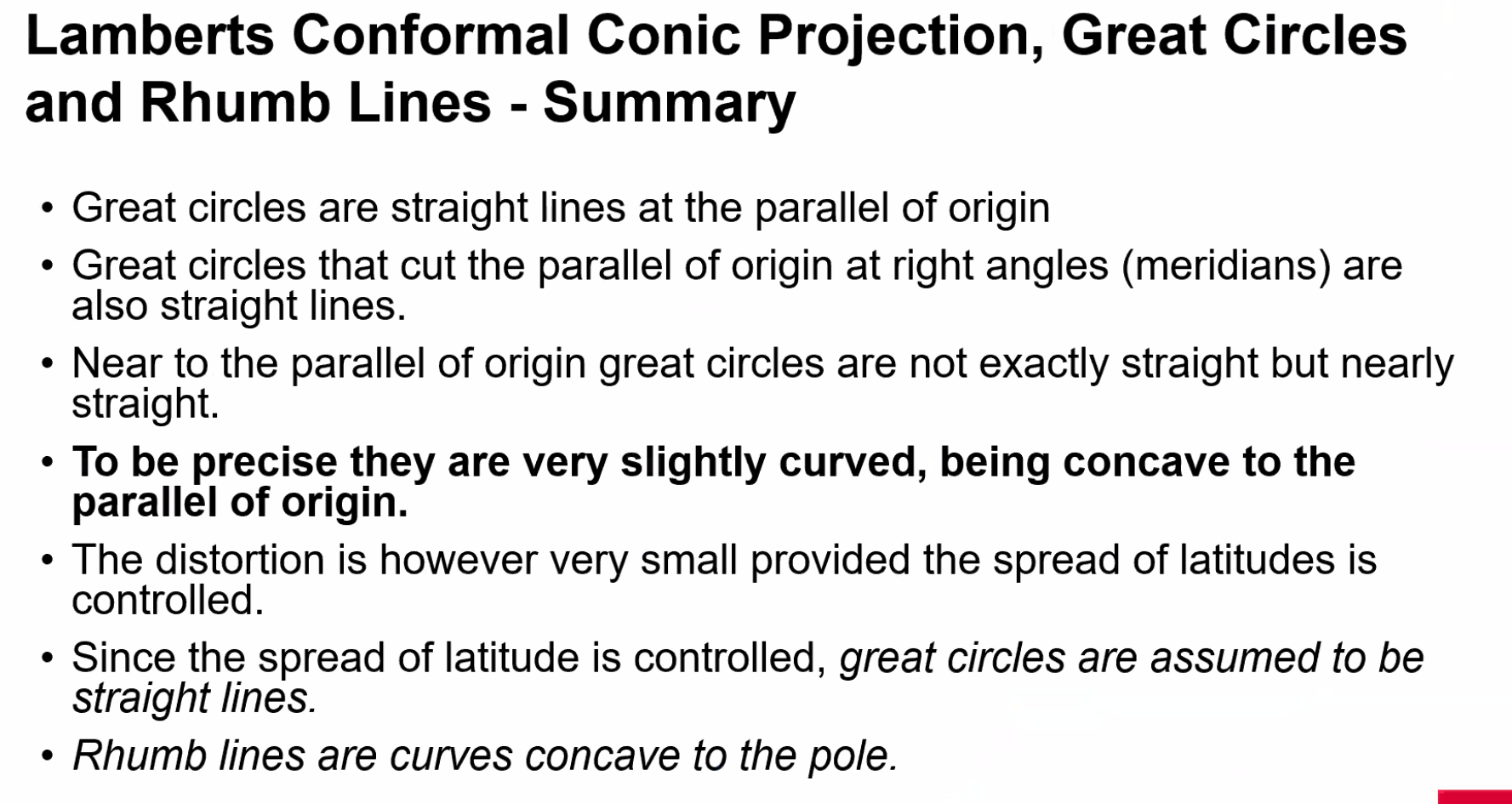
- ==Rhumb Lines: On the equatorial side of the GCT, concave to the nearest pole==
- ==Great Circle: Curves concave to the Parallel of Origin but to all intents and purposes a straight line==
Great circles over the pole are straight lines. All others are nearly straight and are actually concave to the Pole (PoO). Rhumb Lines are on the equatorial side of the GCT.
Polar Stereographic Projection
Key Questions
Q. Where is the scale correct? A. ==At the pole (where the paper touches the surface)==
Q. Where is the convergency of the meridians correct? A. ==At the Parallel of Origin - the Pole==
Q. What do great circles and rhumb lines look like on the projection? A. Straight lines through the pole, others concave to the pole
Isosceles Triangle Method
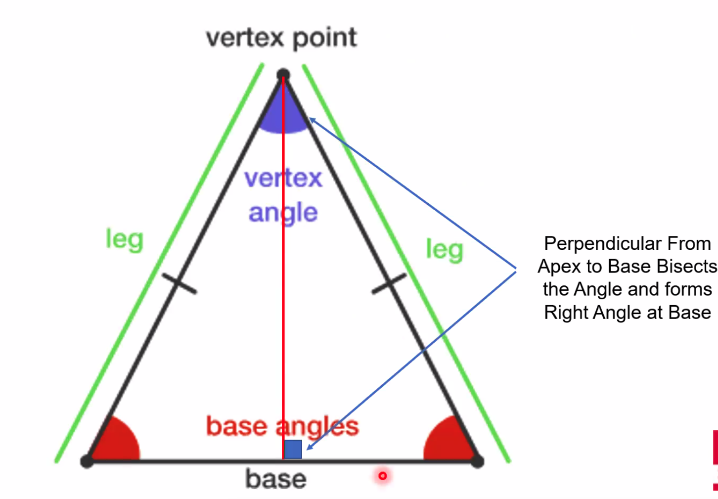
Example Problems
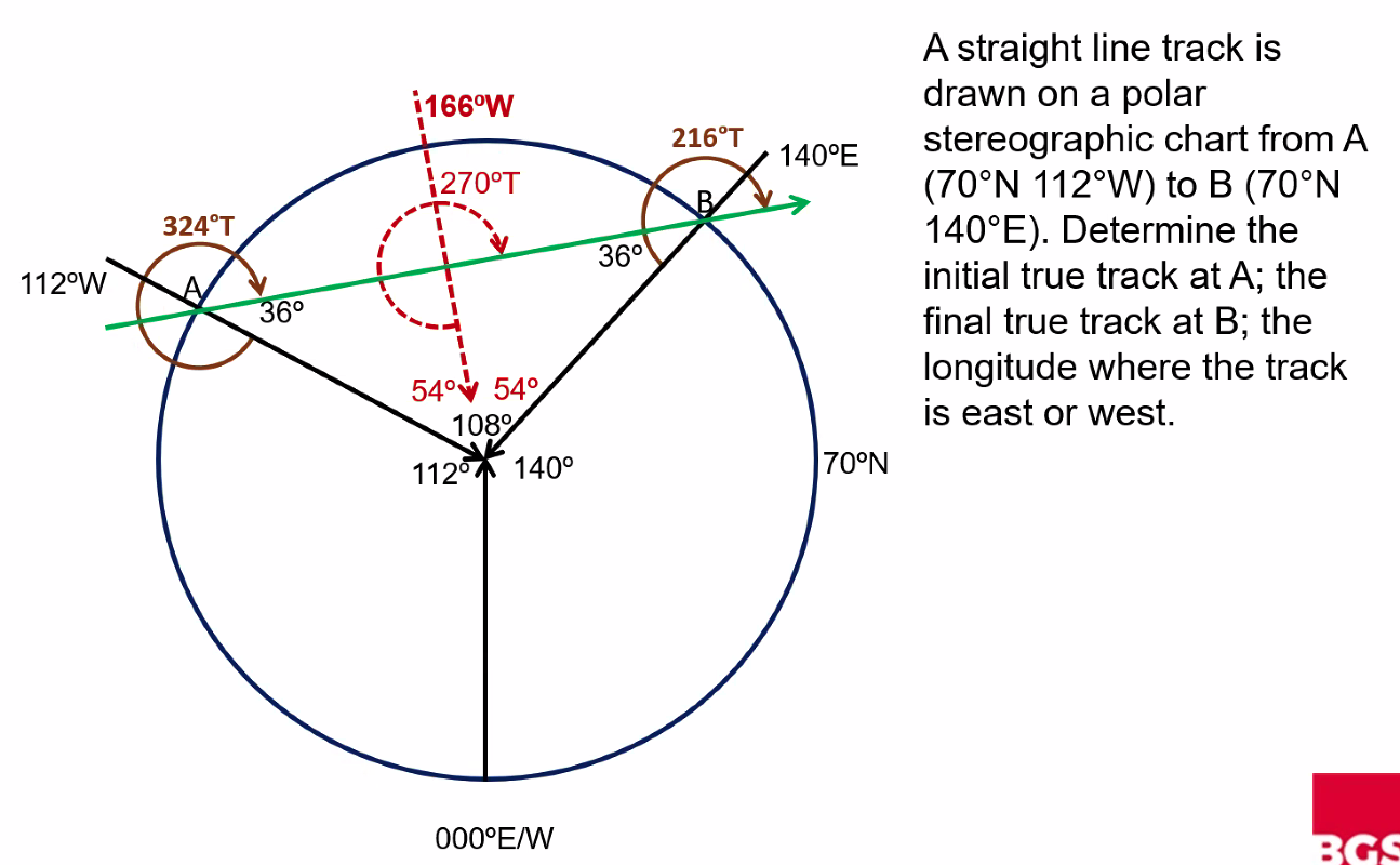
Q. A straight line track is drawn on a polar stereographic chart from A (70°N 112°W) to B (70°N 140°E). Determine the initial true track at A, the final true track at B, the Longitude where the track is east or west. A. A to B: 324°, Track at B: 216°, Longitude of vertex: 166°W
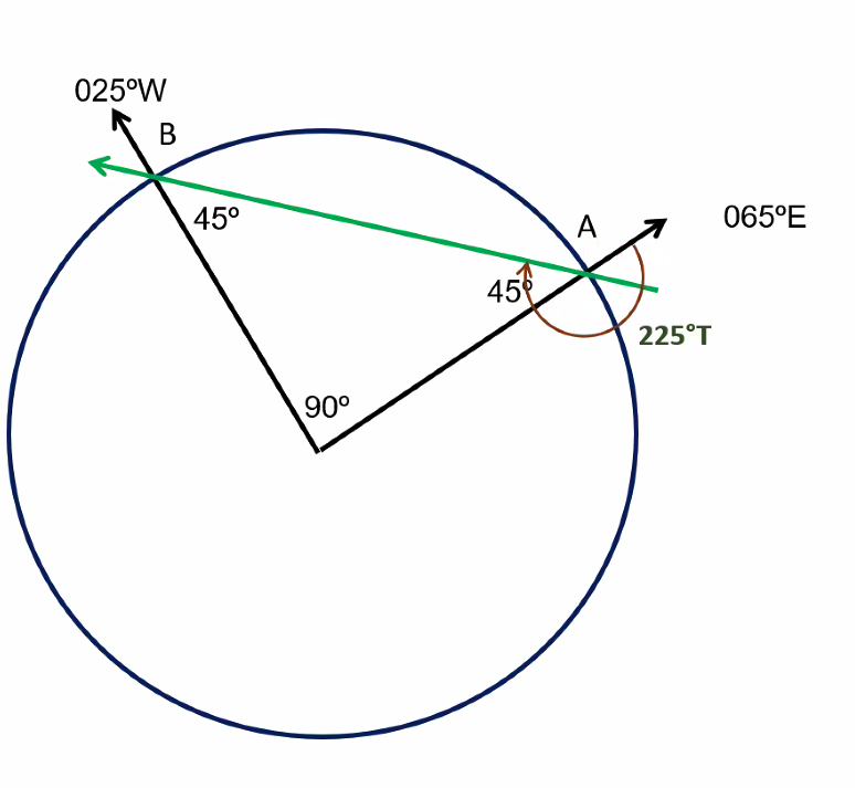
Q. A straight line track is drawn on a polar stereographic chart from A (70°S 065°E) to B (70°S 025°W). Determine the initial true track at A. A. 225°
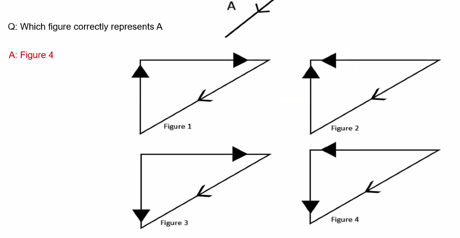
IMPORTANT
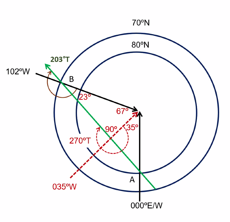
==Remember on Stereographic Charts: If NORTH, draw the arrow from the middle to the bottom. If SOUTH, draw the arrow from the middle to the top (of the circle)==
Q. A straight line track is drawn on a polar stereographic chart from A (80°N 000°E) to B (70°N 102°W). The highest latitude crossed is at 035°W. Determine the true track at B. A. 203°T
Q. A straight line from A (75°N 120°E) to B (75°N 160°E) is drawn on a Polar Stereographic Chart. When passing the meridian at 155°E, the true track is: A. 105°
The Earth, Solar System & Time
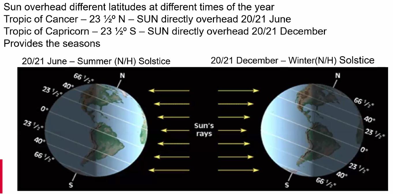
==Earth is tilted 23.5° from perpendicular to orbital plane (Axial Tilt or Obliquity)==
Key Astronomical Terms
The Ecliptic: A great circle on the celestial sphere representing the Earth's apparent path
Aphelion: ==Earth is closest to the sun and faster in its orbit==
Perihelion: ==Earth is furthest away from the sun and slowest in its orbit==
Vernal Equinox: ==Equal length of day/night in Spring==
Autumnal Equinox: ==Equal length of day/night in Autumn==
The Solstices: ==Relative length of day and night changes at its slowest rate==
At all other periods the duration between day and night is changing.
==One orbit around the sun is approximately 365.25 days==
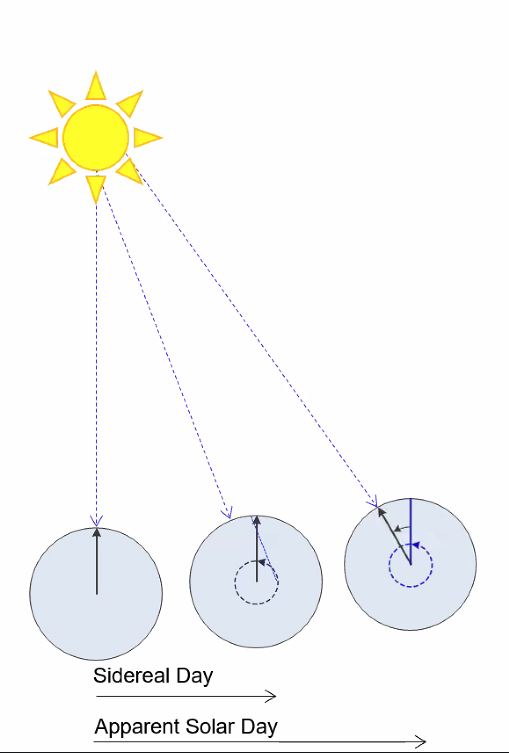
Types of Days
Sidereal Day: ==Length of time Earth takes to revolve 360° - constant 23 hours 56 minutes 4 seconds==
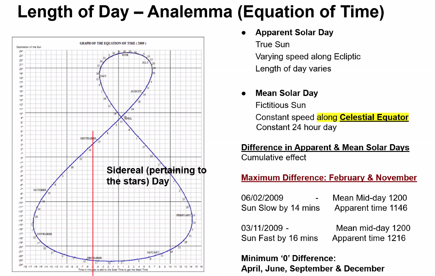
Apparent Solar Day: Length of time it takes Earth to revolve so that the sun is directly overhead the same meridian (Two transits of sun over a Meridian)
Mean Solar Day: ==Average day, 24 hours==
Prograde Planet: ==Sidereal day ALWAYS SHORTER than Mean Solar Days==
Difference between Apparent and Mean solar days is shown by the Analemma
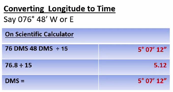
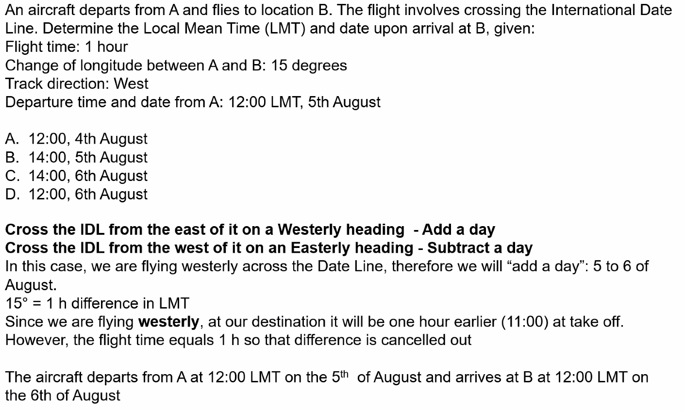
Local Mean Time
Time dependent on Longitude
IMPORTANT
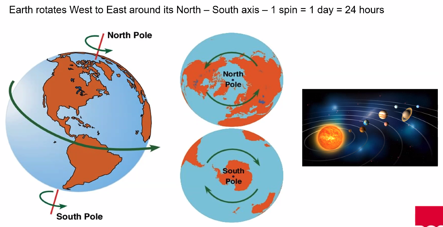
==Earth Rotates:==
- ==360° in 24 hours==
- ==15° every hour==
- ==1° every 4 minutes==
Time Calculation Problems
Q. Time difference is 9 hours 17 mins. Calculate the corresponding difference in Longitude? A. 139°15'
9h 17m × 15 = 139°15’
Q. If time in London at 000°E/W is 1200 Local Mean Time, what is local mean time in Bristol 002°30’W? A. 1150
Q. If the local mean time is 16:47 on 1st April in Ottawa, Canada (N45° W076°), what is the local mean time in Mogadishu, Ethiopia (N02° E046°)? A. 00:55 AM 2nd April

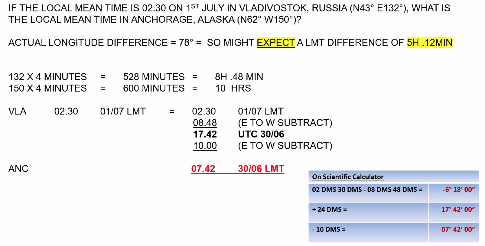
Q. If the local mean time is 02:30 on 1st July in Vladivostok, Russia. What is the local mean time in Anchorage, Alaska (N62° W150°)? A. 07:42 AM previous day
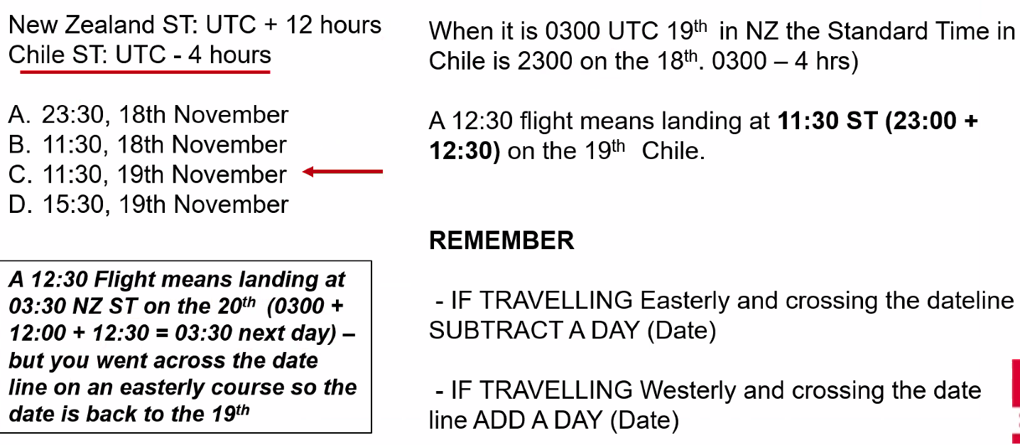
Q. Determine the standard time (ST) and date of arrival in Chile, given the following information:
- Route: New Zealand to Chile, crossing the international date line on an easterly course
- Departure time and date: 0300 UTC, 19th November
- Flight Time: 12 hours 30 mins
- New Zealand ST: UTC + 12 hours
- Chile ST: UTC - 4 hours
A. 11:30, 19th November
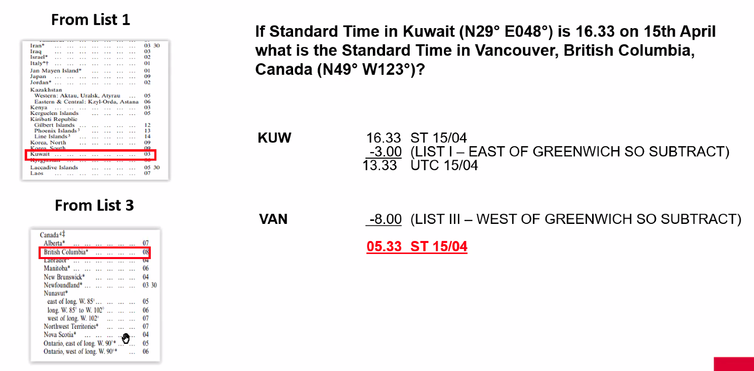
Q. If the standard time in Kuwait (N29° E048°) is 16:33 on 15th April. What is the standard time in Vancouver, British Columbia, Canada (N49° W123°)? A. 05:33 AM ST 15/04
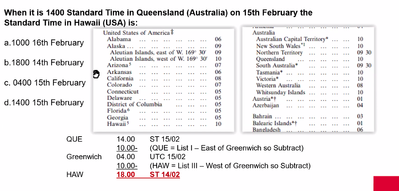
Q. When it is 1400 Standard Time in Queensland (Aus) on 15th February the standard time in Hawaii (USA) is: A. 1800 14th February
Q. An aircraft takes off from Guam (13°N 145°E) at 1900 Standard Time on 1st June local date. After a flight of 10 hours 15 mins it lands at Los Angeles (California USA). What is the Standard Time and local date of arrival (assume summer time)? A. 1215 on 1st June
1900 in Guam - 10 hours = 0900 UTC, - 8 hours = 0100 in LA. 0100 + 10hrs 15 = 1115 + summer time = 1215 1st June
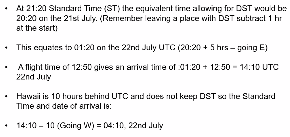
Q. An aircraft leaves New York USA, for Hawaii, USA, on the 21st July, 2018, at 21:20 Standard Time. Assume daylight saving time applies except for Hawaii. The flight time is 12 hours 50 mins. What will be the Standard Time and date of arrival? A. 04:10 22nd July
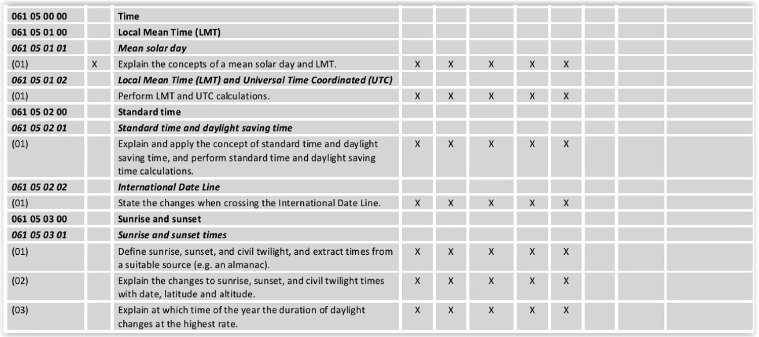
Sunrise and Sunset
Horizon Definitions
Sensible Horizon: As you would measure with a flat ruler laid at a tangent to the Earth's surface
Visible Horizon: The horizon that we can see
Sunrise/Sunset Definition
Sunrise/Sunset is the LMT when:
- ==The top lip of the sun just rises above, or disappears below the visible horizon; OR==
- ==When the center of the sun is 16 minutes below the visible horizon; OR==
- ==When the centre of the sun is 16 minutes + 34 minutes = 50 minutes of arc below the sensible horizon==
Civil Twilight
Morning Civil Twilight: ==Starts when the centre of the sun is 6 degrees below the sensible/true/celestial horizon and ends at sunrise==
Evening Civil Twilight: ==Starts at sunset and ends when the centre of the sun is 6 degrees below the sensible/true horizon==
Twilight: The period between the start of morning civil twilight and sunrise OR sunset and the end of evening civil twilight
Sunrise/Sunset Problems
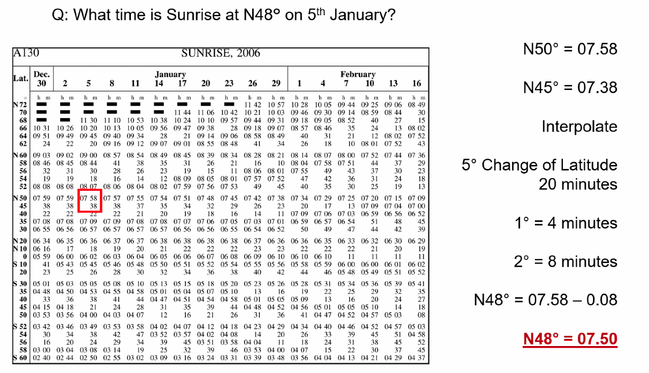
Q. What time is sunrise at N48° on 5th January? A. 07:50
Q. On the 16th of February at 52°S and 040°E, the sunrise is at 0223 UTC. On the same day, at 52°S and 035°W, the sunrise is at: A. 0723 UTC
While the Latitude is the same you’ll need to work out the longitudinal time difference. 75 degrees × 4 = 300 minutes, 300 / 60 = 5 hours
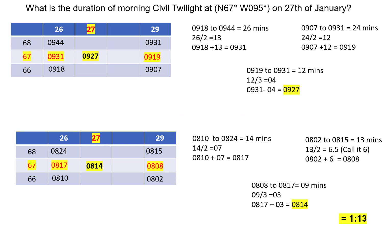
Q. What is the duration of morning Civil Twilight at (N67° W095°) on 27th January? A. 1 hour 13 mins
We got these values from the Almanac
Polar Days and Midnight Sun
==66.5°N/S: Above this latitude there are winter days where the sun does not rise==
==60.5°: The lowest latitude at which a state of permanent civil twilight will occur==
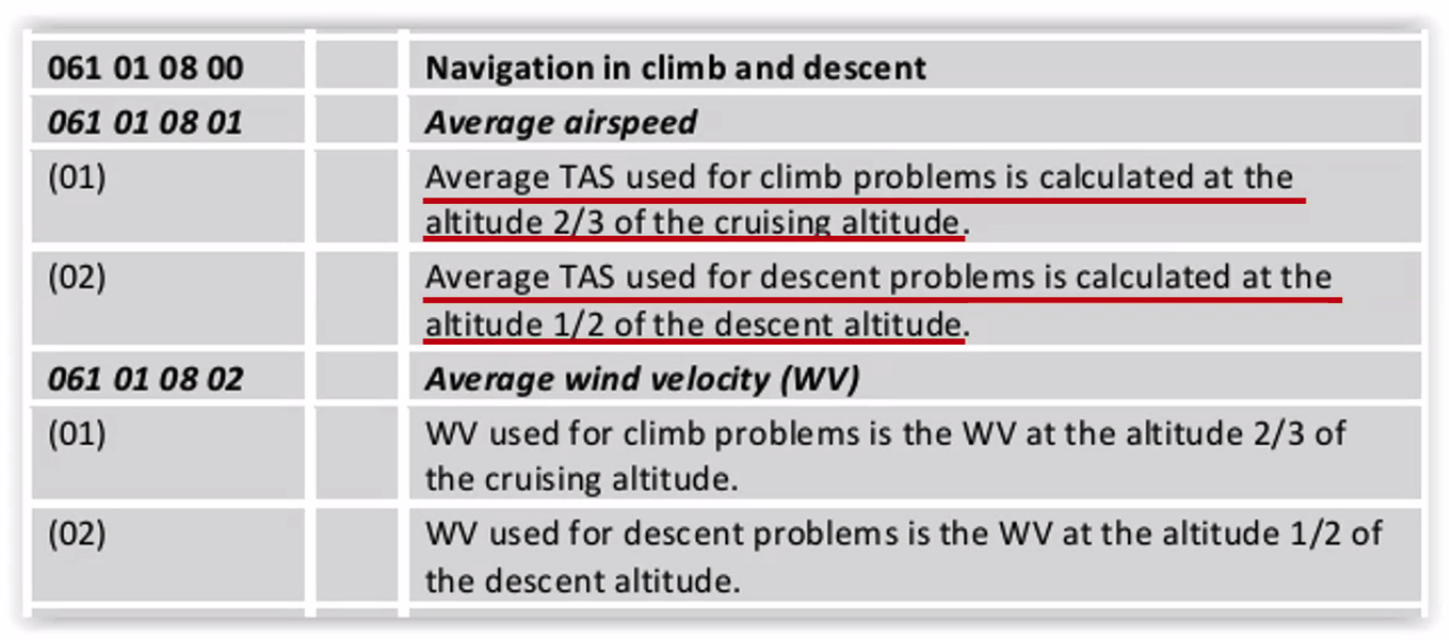
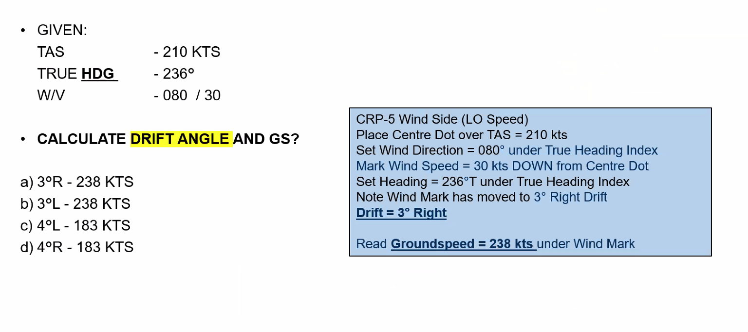
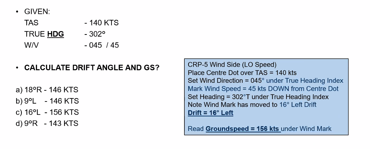
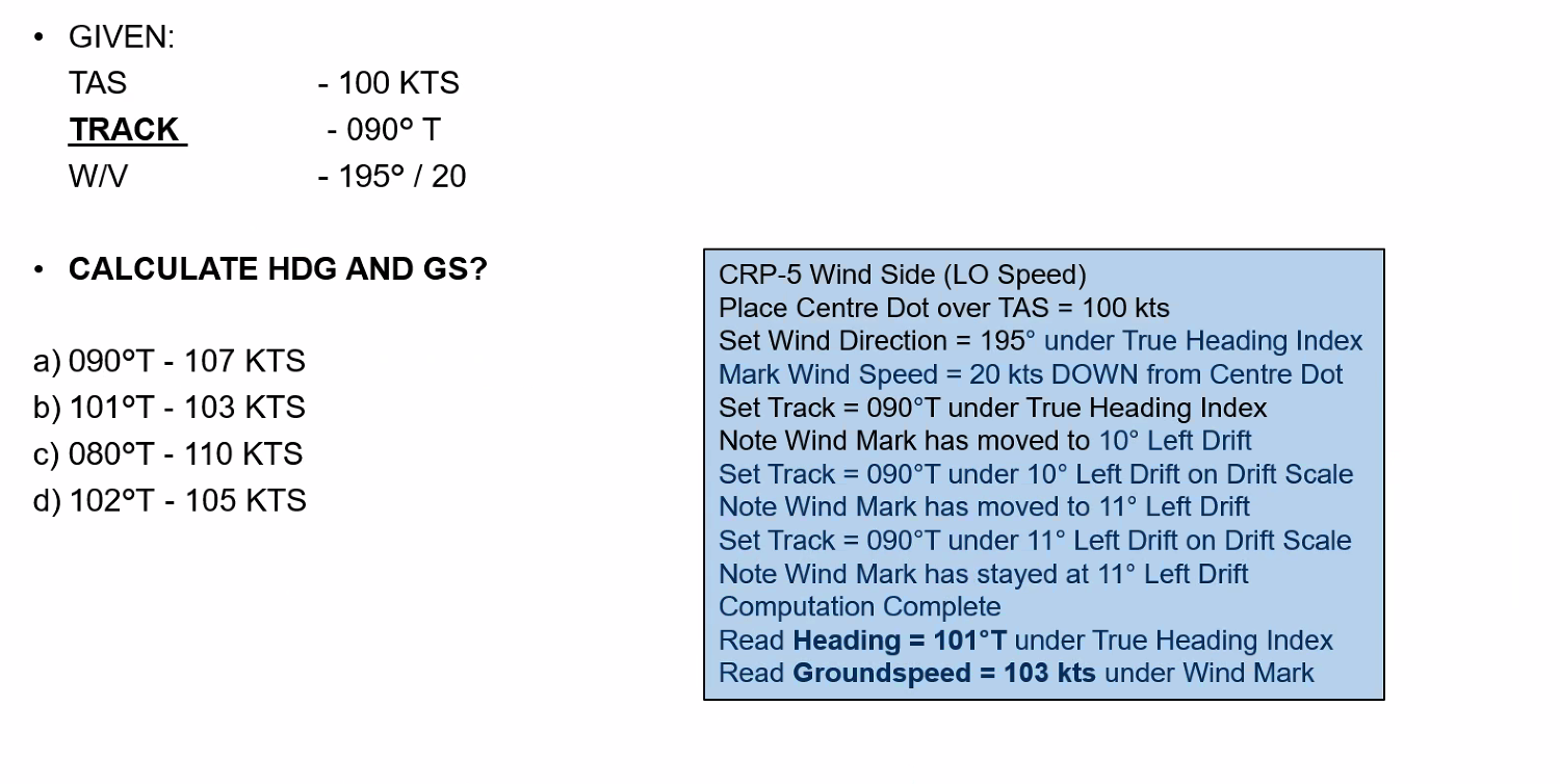
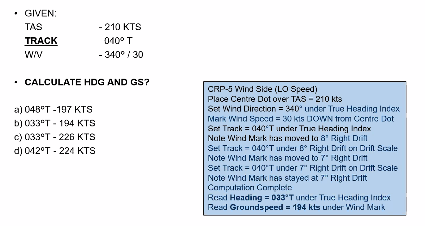
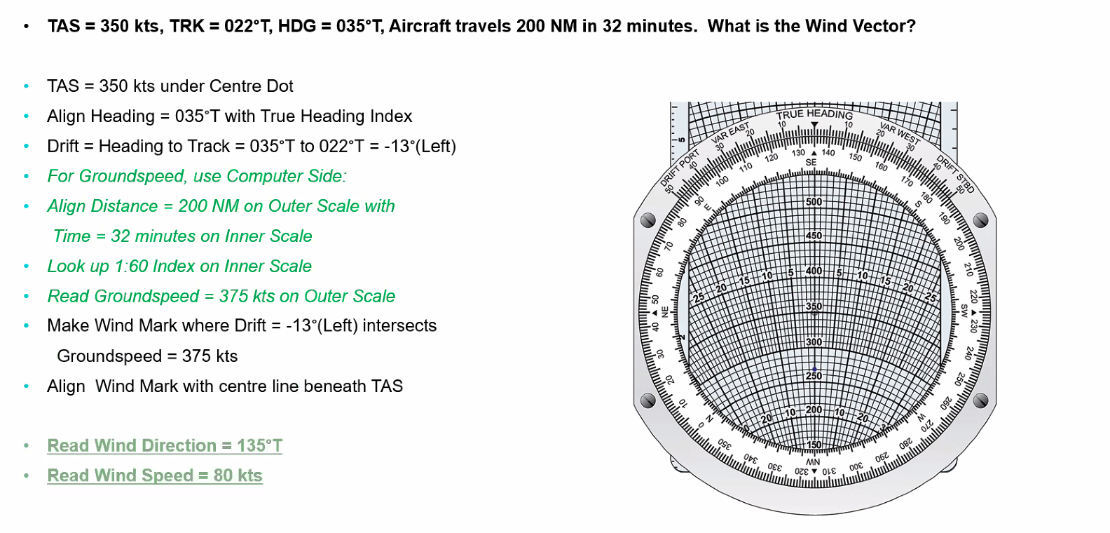
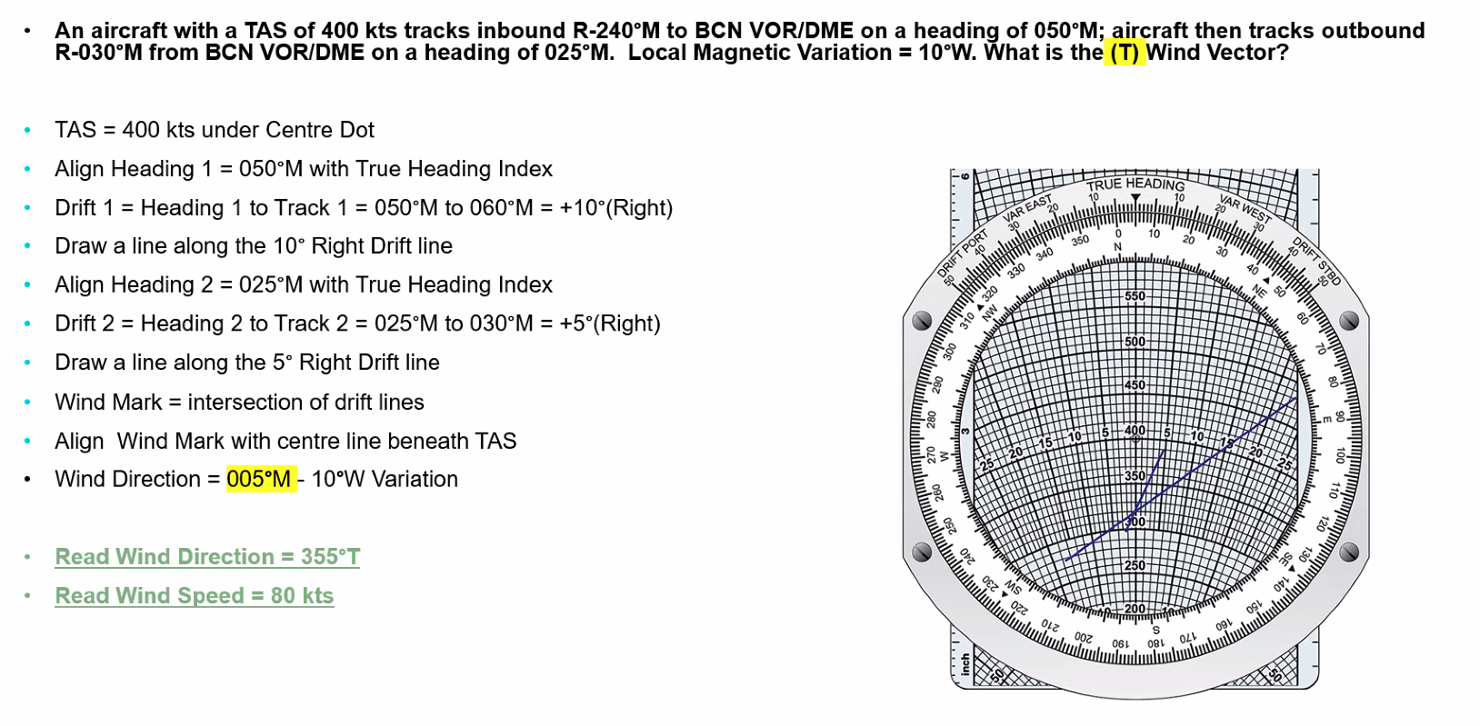
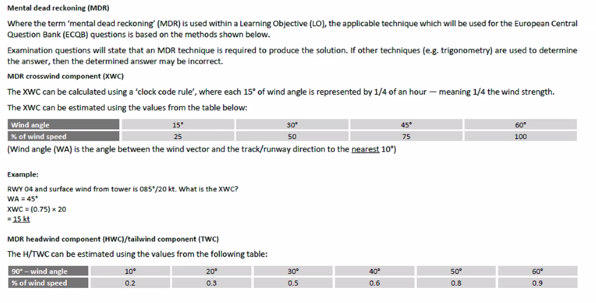
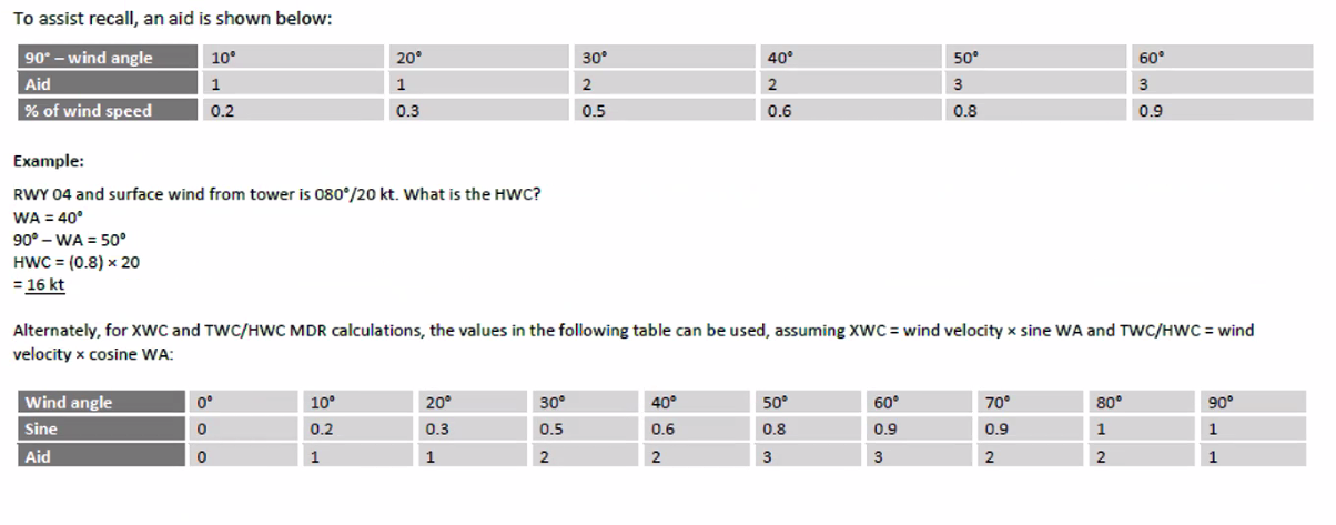
Mental Dead Reckoning (MDR)
WCA (Wind Correction Angle): How many degrees left or right of track we need to make our heading in order to compensate for crosswind
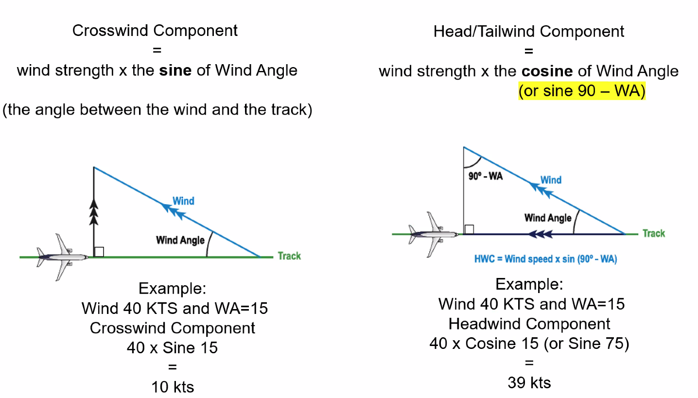
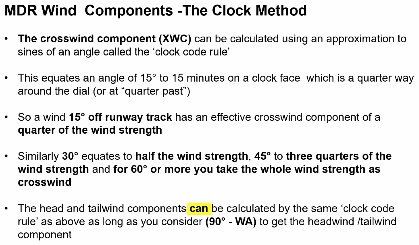
Crosswind and Headwind Components
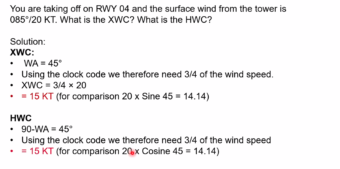
Q. You are taking off on RWY 04 and the surface wind from the tower is 085°/20 kts. What is the XWC? and what is the HWC? A. ==WA = 45°, XWC = 15 KT, HWC = 15 kt==
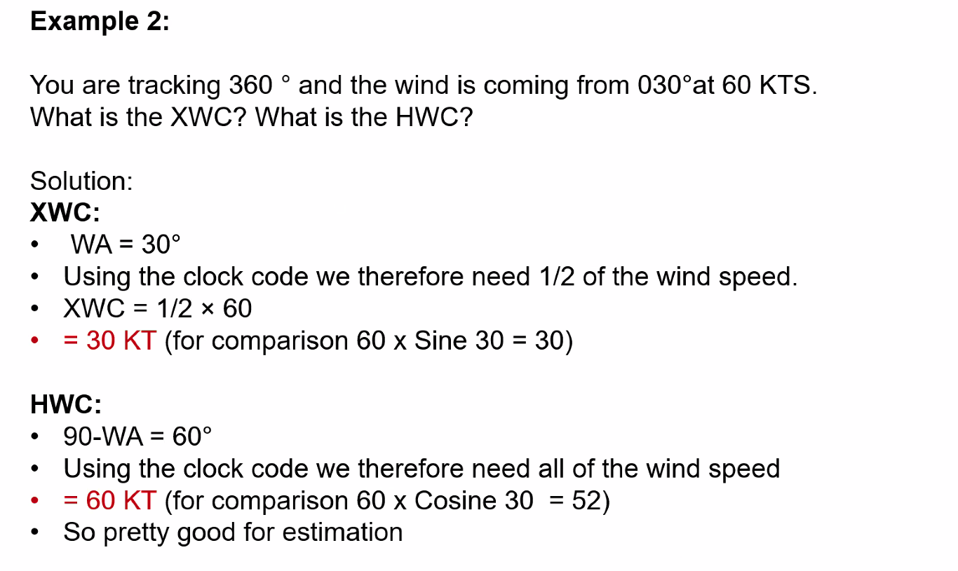
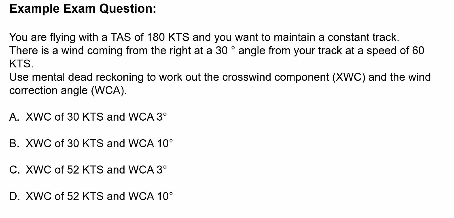
Q. You are tracking 360° and the wind is coming from the 030° at 60 kts. What is the XWC? and what is the HWC? A. ==XWC = 30 kts, HWC = 60 kts==
Q. The TAS is 240 kt and the wind is below 30° right of your track at 60 knots. Determine the groundspeed using MDR. A. 186 kts
Remember on the HWC we need to minus the Wind Angle from 90°. 90° - 30° = 60°. 60° = 90% of wind, 60 × 0.9 = 54 kts 240 - 54 = 186 kts
Speed Factor
==The Speed Factor = Aircraft speed in NM per minute==
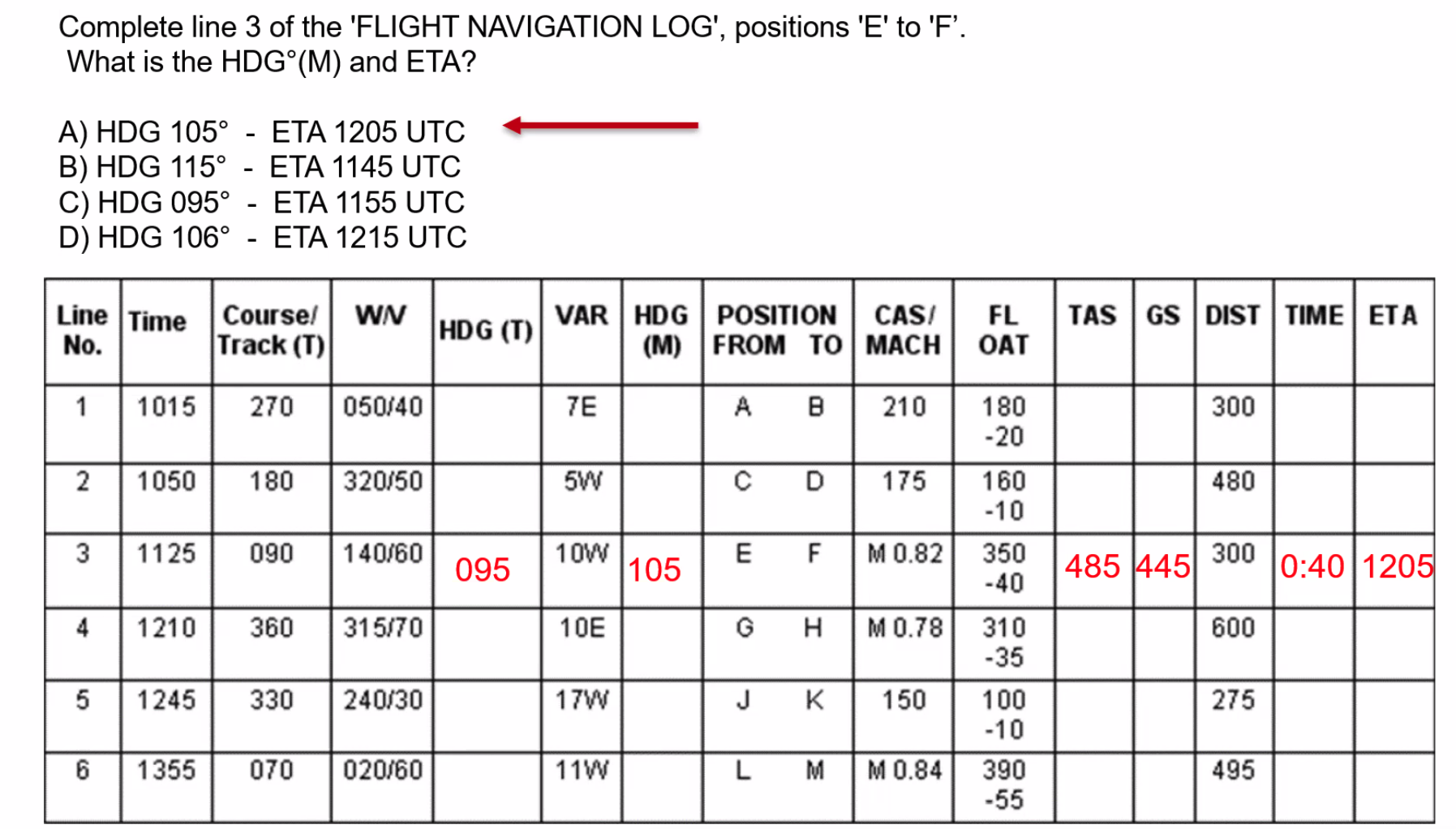
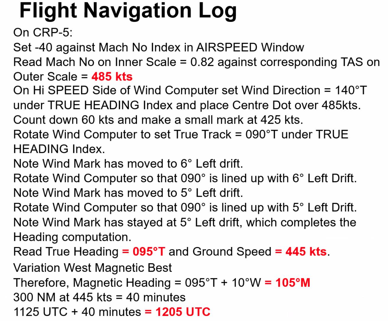
Q. Planned Track = 070°T, TAS = 400 KT, WV = 100°T/20 kt. Using MDR Techniques determine the required heading and the groundspeed. A. ==3° right WCA, Heading = 070° + 3° = 073°==
Heading is determined by calculating the XWC and using the Speed Factor to get the drift affecting the aircraft and then applying the WCA (same magnitude opposite direction to the drift).
WA = 100° - 70° = 30° XWC = 50 × 0.5 = 20 KT Speed Factor = 400 / 60 = 6.66 WCA = 20 / 6.66 = 3°
Ground speed is determined by finding 90° - WA and using the clock code. 90° - 30° = 60° HWC = 40 kts × 0.9 = 36 kts GS = 400 - 36 = 364 kts
Q. Planned Track = 330°T, TAS = 240 KT, WV = 210°T / 70 KT. Use MDR techniques to determine the required heading and the groundspeed.
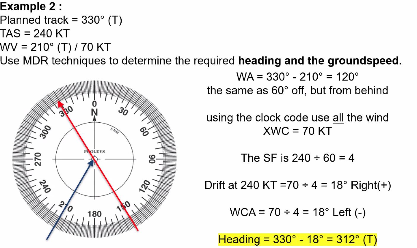
XWC = 1/2 × 60 = 30 kts WCA = 30 / SF WCA = 30 / 3 = 10° Drift is left so WCA is right.
Answer: B
Off Track Corrections
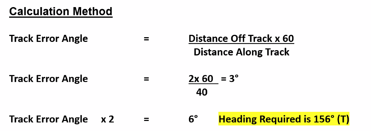
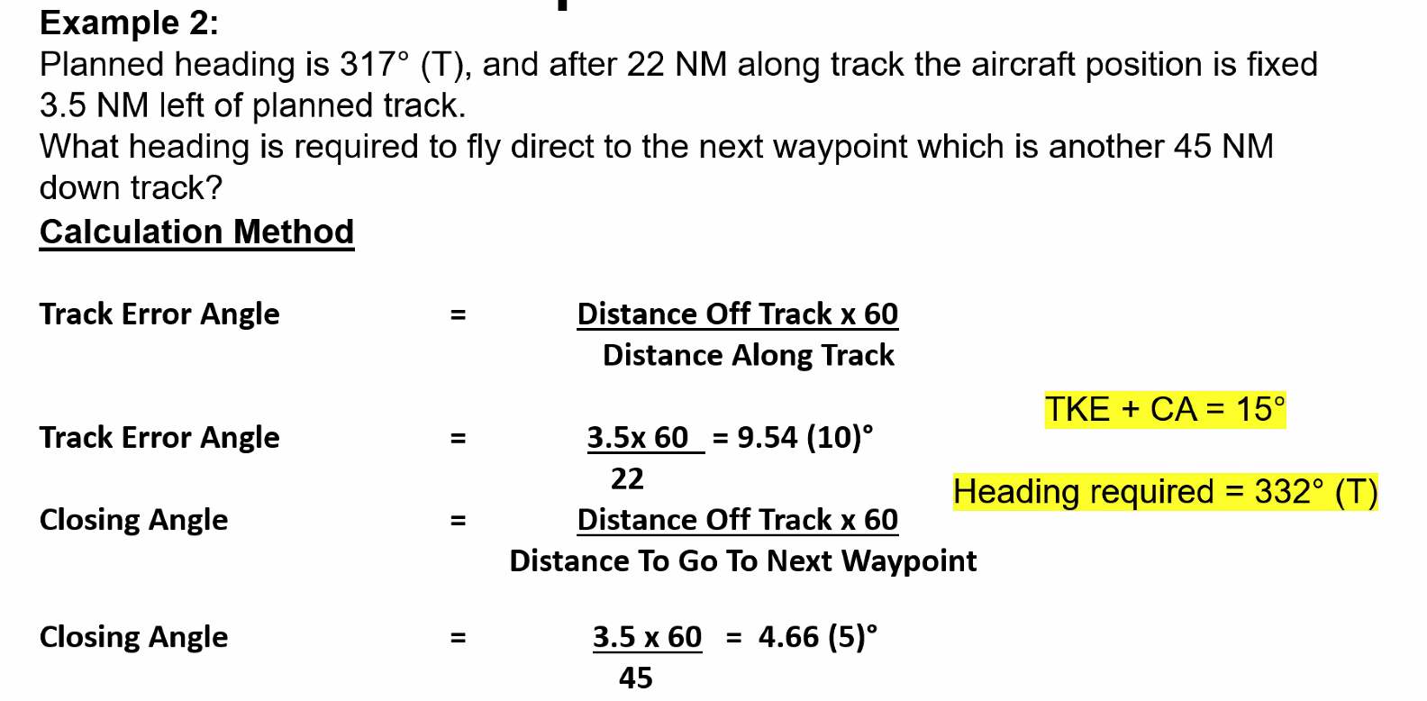
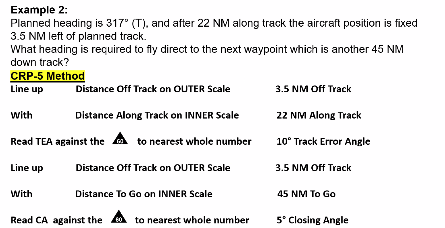
Track Error Formulas
==1 NM of cross track error for every 60 NM along track from waypoint = 1° of track error angle (TKE)==
==1 NM of XTE/DOT for every 60 NM along track to waypoint = 1° of closing angle==
==Change of heading required to reach next waypoint from position off track = TKE + CA==
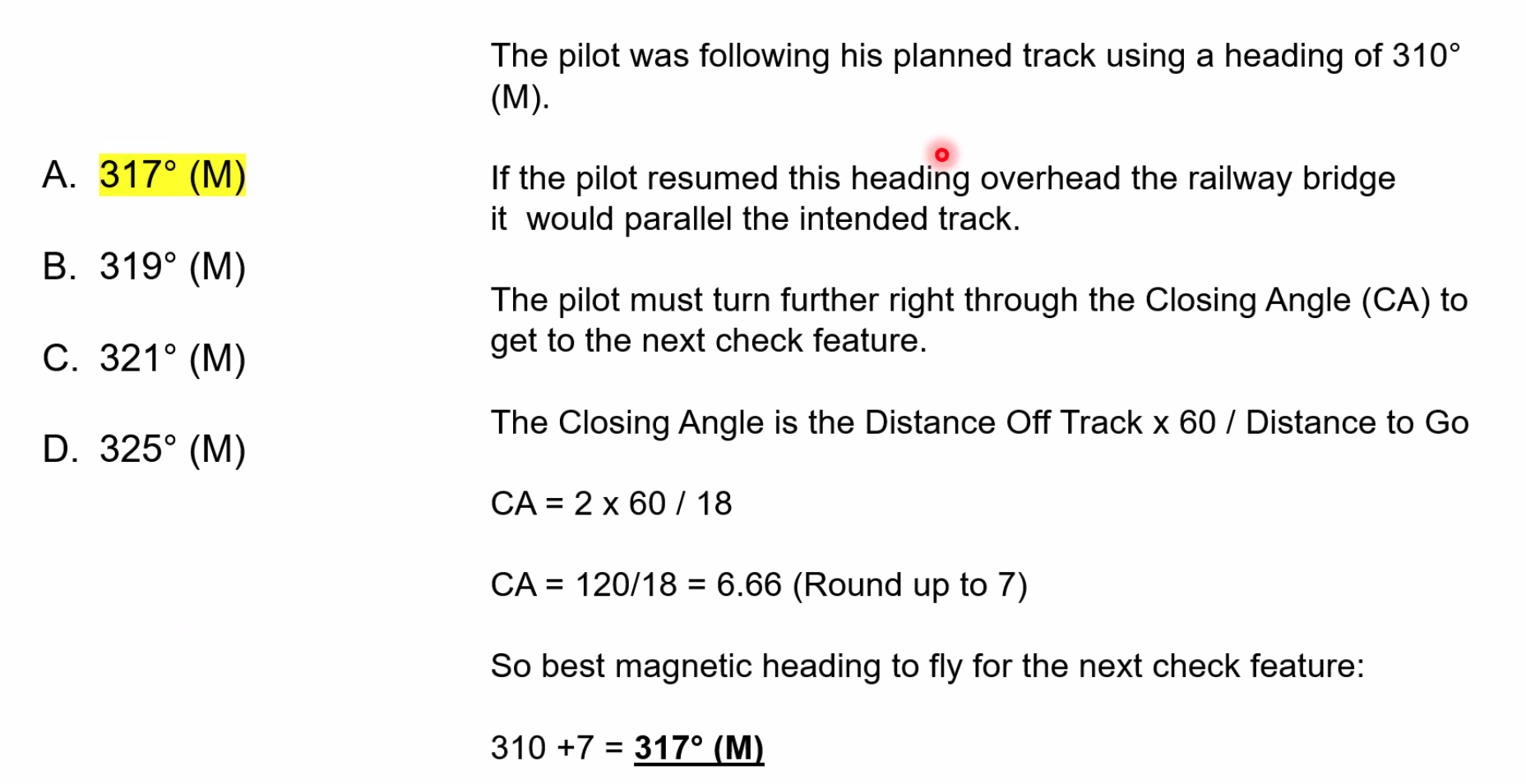
Q. Planned heading is 162°T and after 40 NM along track the aircraft position is fixed 2 NM right of planned track. What heading is required to regain track in approximately the same time as has taken to the fix position?
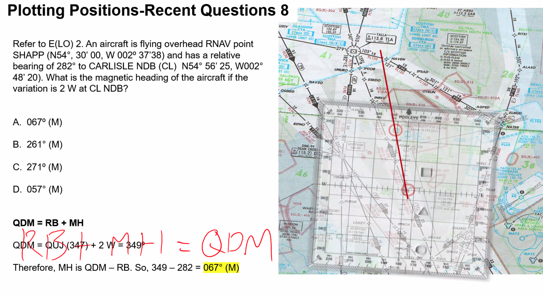
Plotting VFR Nav & Practical Navigation
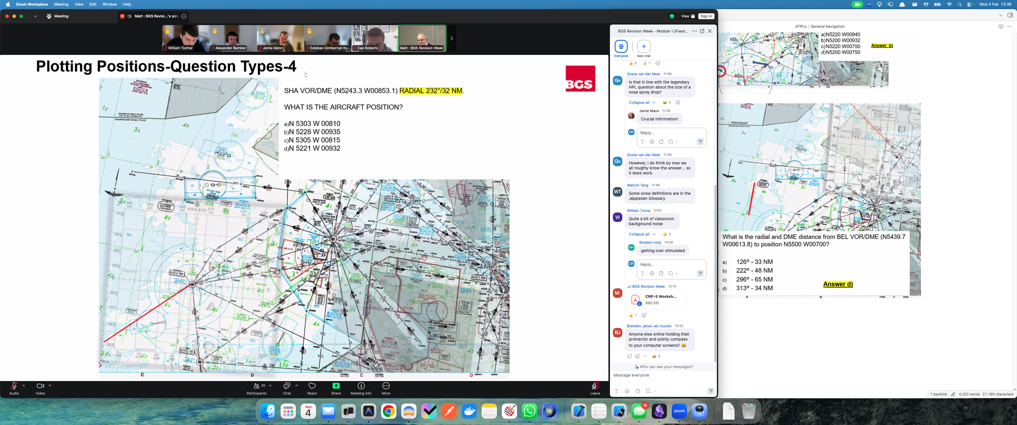
Q. Given SHA VOR. Aircraft position of N5210 W00910. Which of the following lists the radial applicable to the aircraft position?
A. 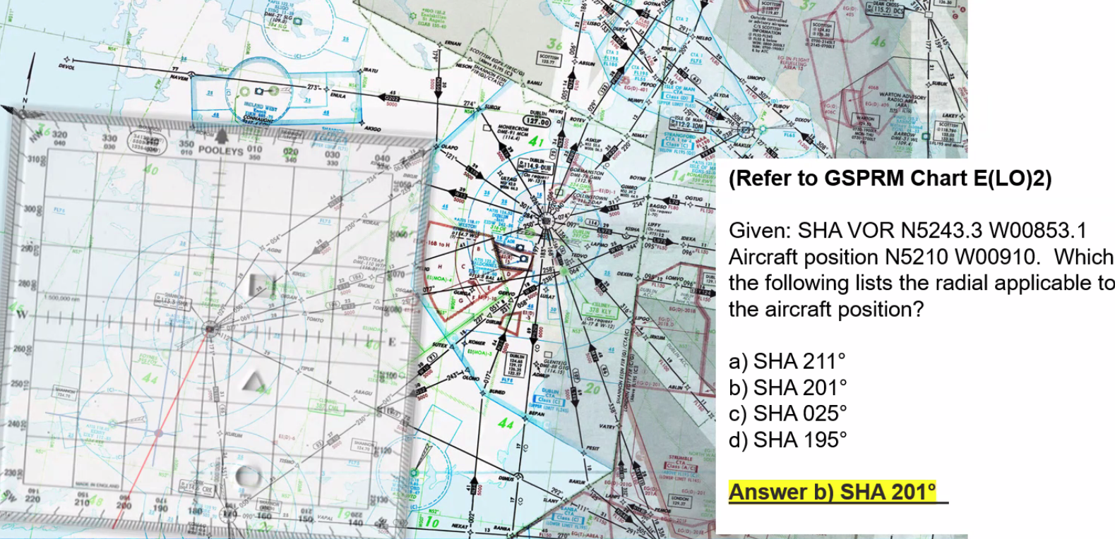
Line protractor with an airway
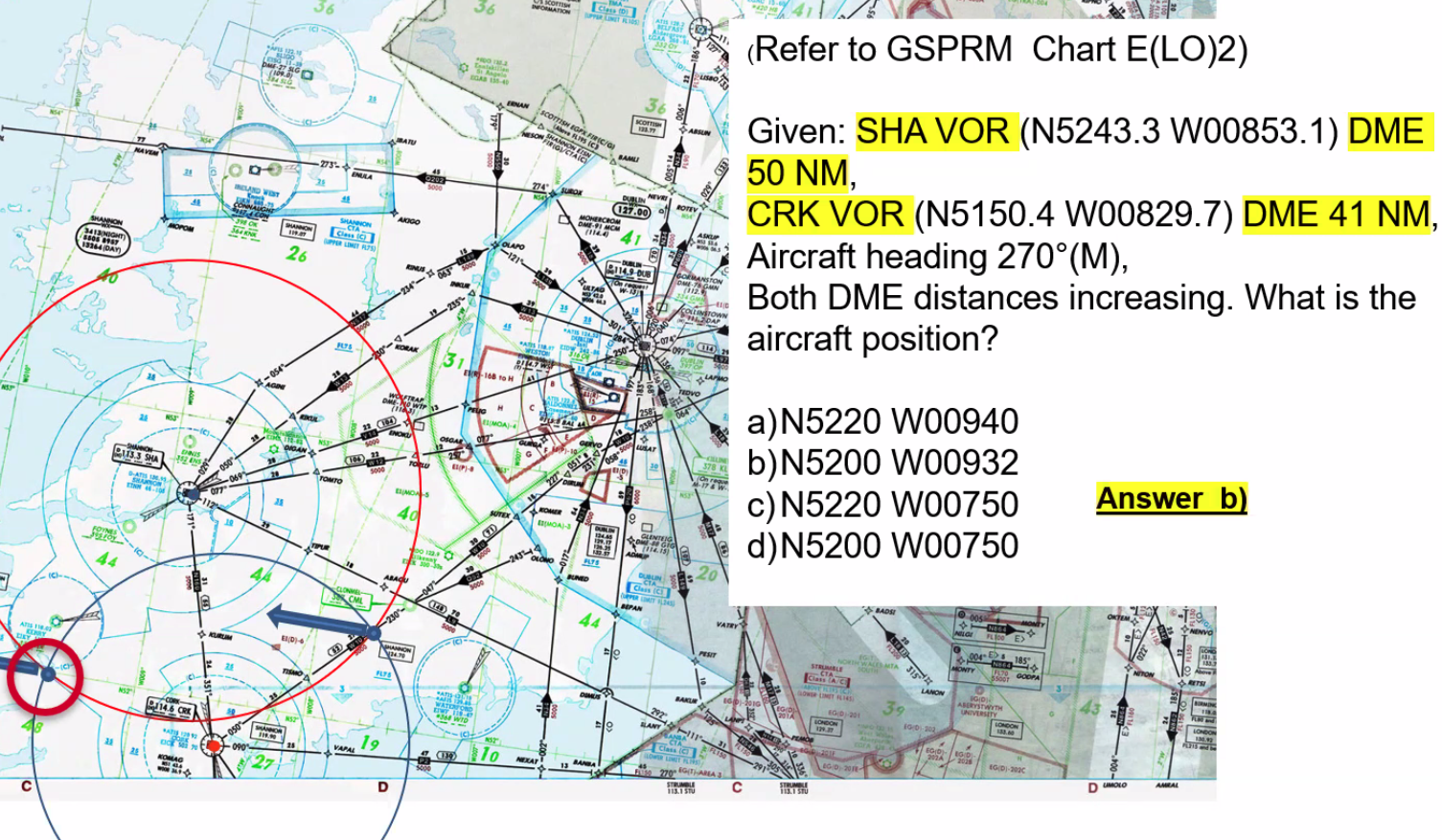
On TACAN, civilian aircraft can only use the DME on a TACAN
Choice of ground feature is critical, as things that show up well on maps do not necessarily show up from the air
- Proximity to planned track
- Size and uniqueness
- PLanned Alt
- Time of year - snow cover, colours of vegetation etc
Some of the easiest to spot are:
- Airports with paved runways
- Railways
- Motorways
- Major Road Intersections
- Large Rivers and Large Lakes / definable shapes
- Towns with Prominent and Unique Features
- Wind Farms / other vertical objects
Q. A pilot is planning for a VFR cross-country flight, using visual checkpoints. Which of the following would be the most suitable checkpoint? A. A feature that contrasts with its natural surroundings?
Q. You are flying over land covered in snow with no visual features you should? A. Turn at the time expected overhead the next waypoint
Q. When flying a day VFR flight at low level, using checkpoints on a 1:500000 map the most suitable features are: A. Those most prominent, large urban towns
Dead Reckoning - process of calculating the current position of the aircraft by using a previously determined position
The accuracy of DR depends on the following:
- accuracy of last fix
- accuracy of heading maintained
- accuracy of airspeed maintained
- accuracy of wind affecting the aircraft
==Q. A difference between a fix and a DR position may be due to the different between the…== A. Actual wind and Forecast wind
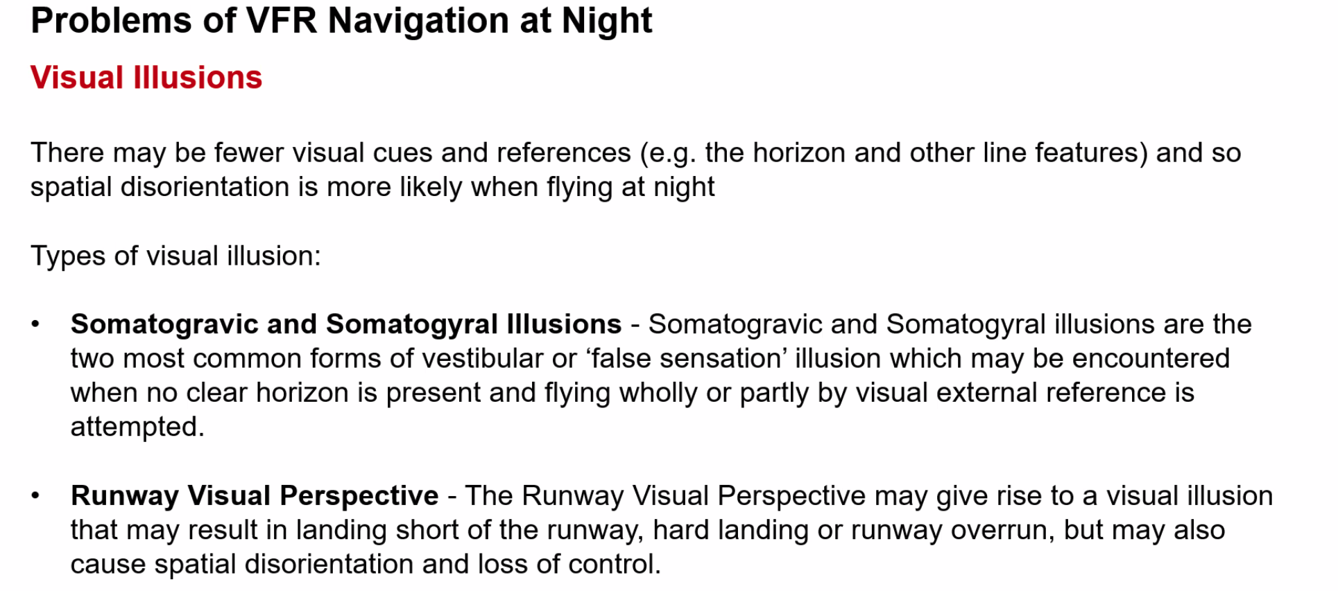
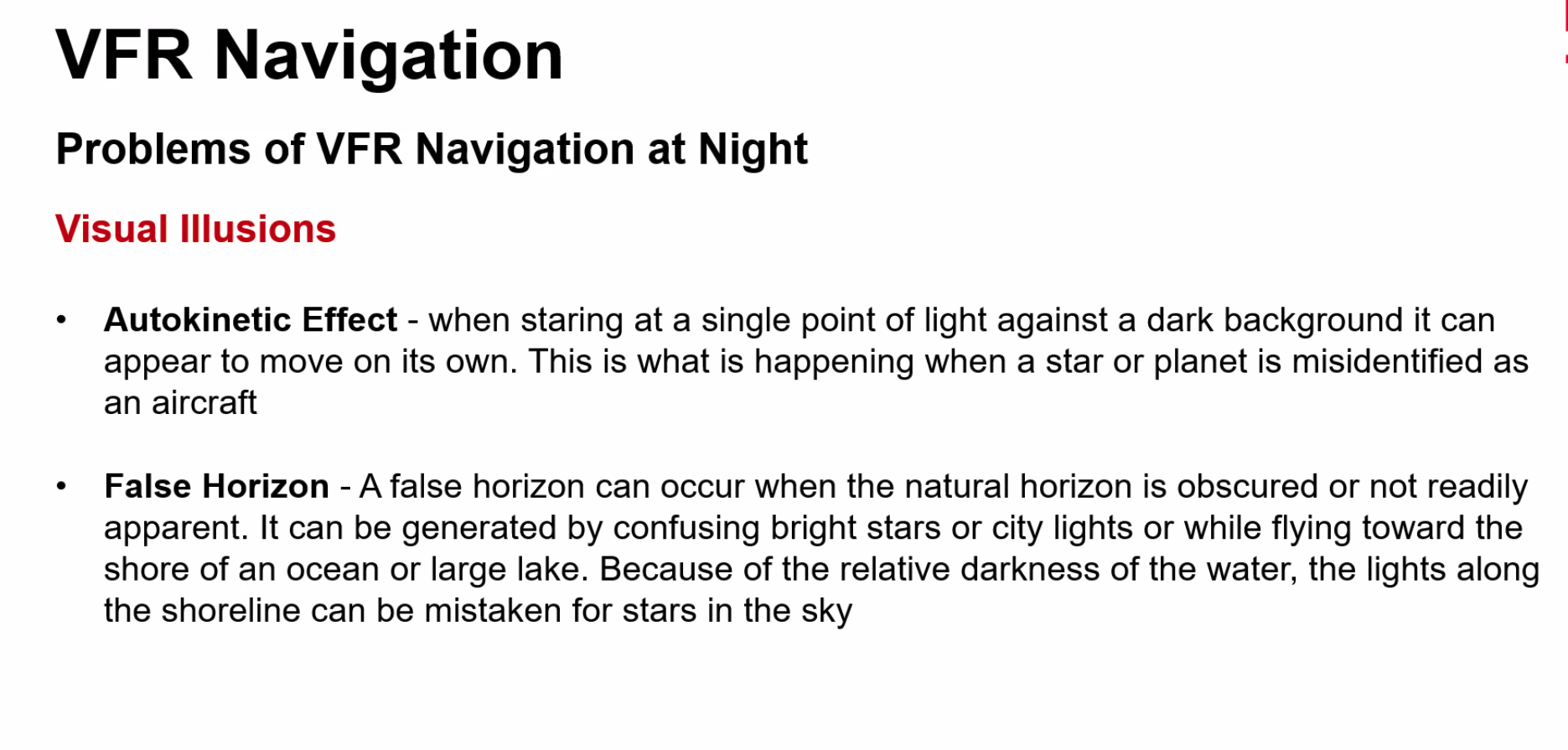
==Q. Which option describes the greatest potential threat for VFR navigation at night?== A. The aircraft height during an approach can be easily misjudged due to insufficient visual cues
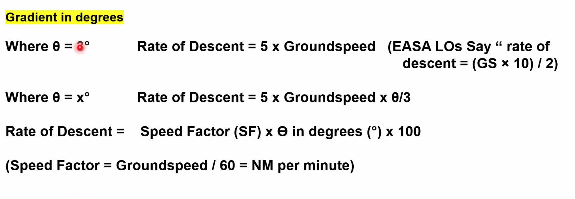

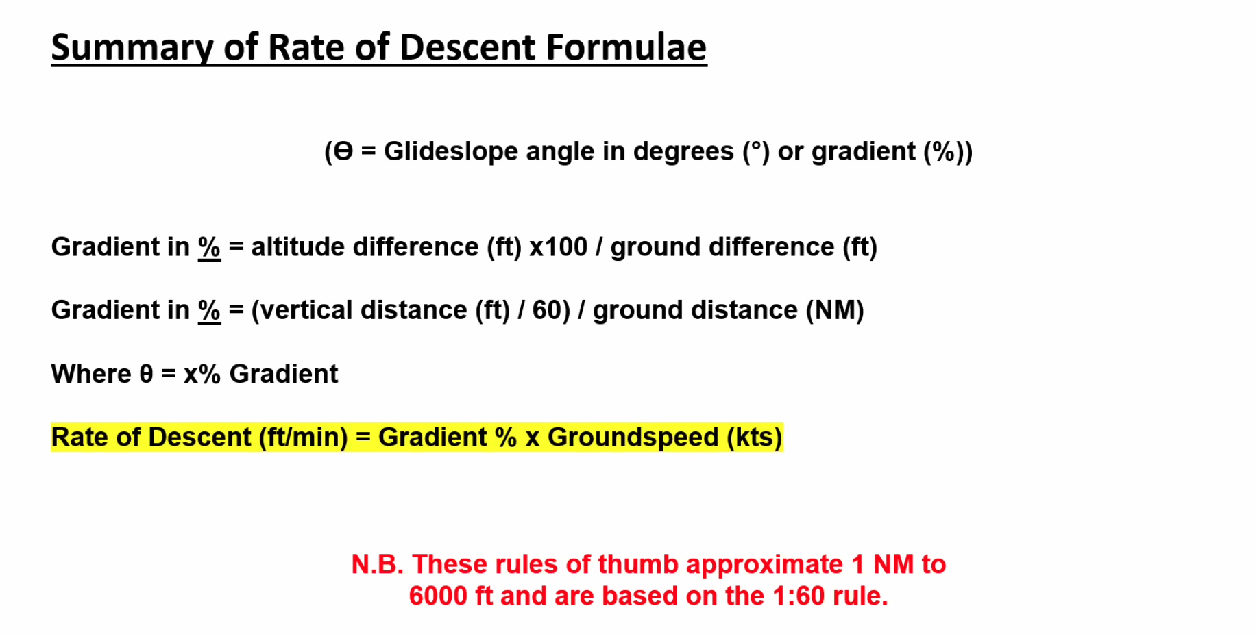
9/10 the Rate of Descent = 5 x GS will work
Q. THe aircraft has an airspeed of 110 knots. THe tailwind is 15 knots. The ILS glida path is published at 3.5 deg. What rate of descent should be set to achieve that glide path?
A. 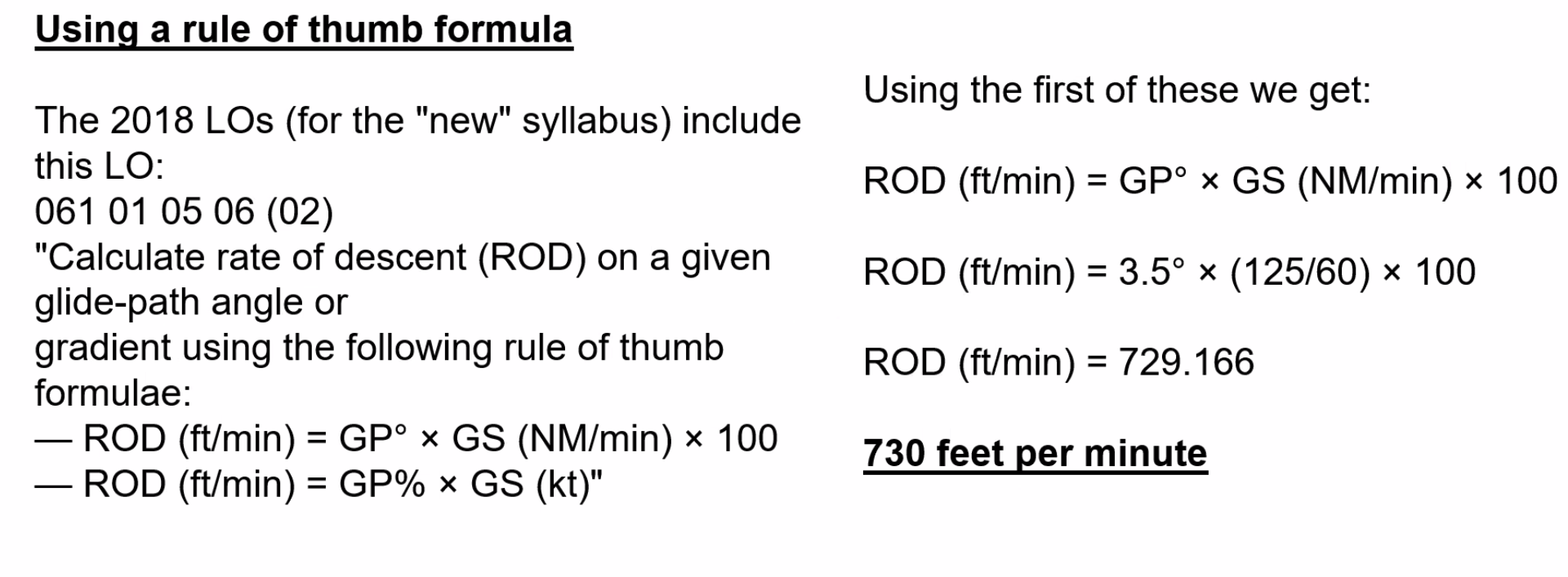 OR (5 x 125) x 3.5/3 = 730
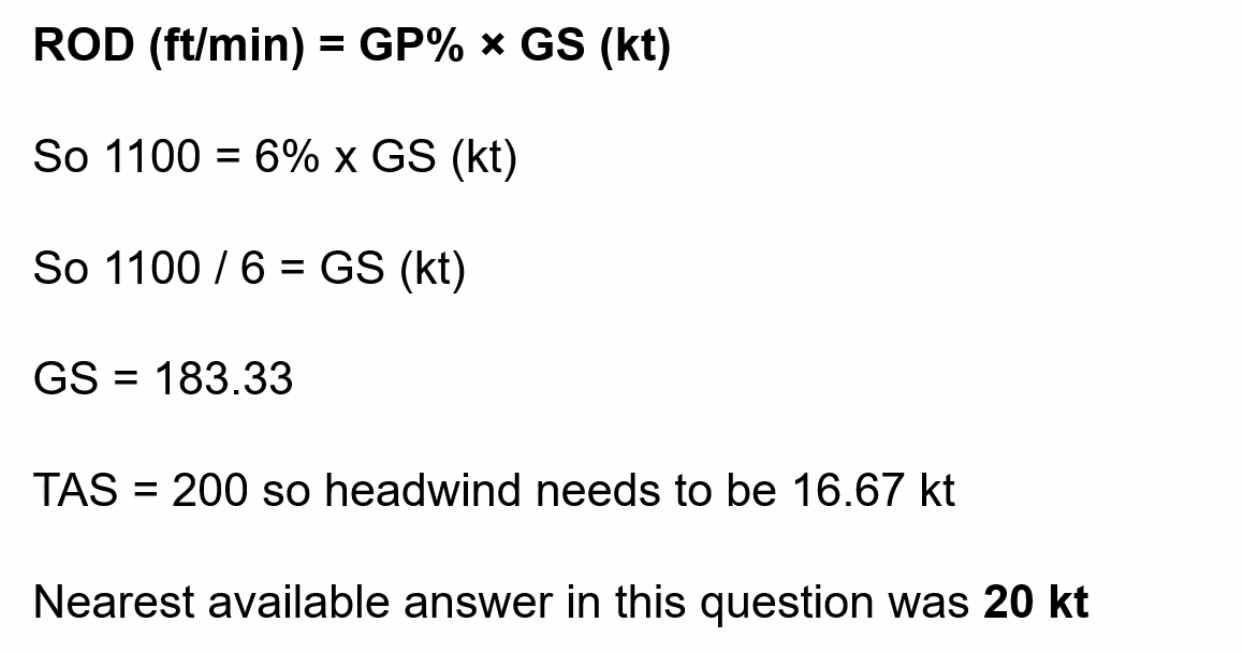
==Q. Your rate of climb is calculated as 1100 feet per minute at a TAS of 200kt. At that airspeed, what minimum headwind component is required to achieve a climb gradient of 6%?==
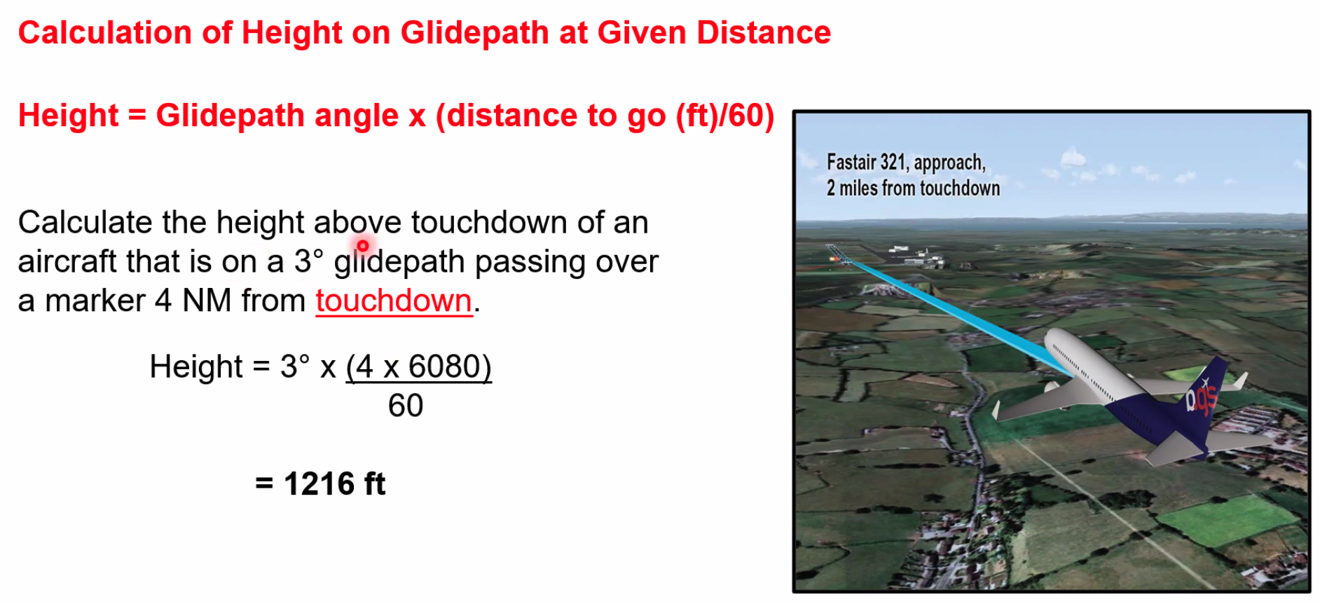 Add 50ft if the distance is measured from the threshold.
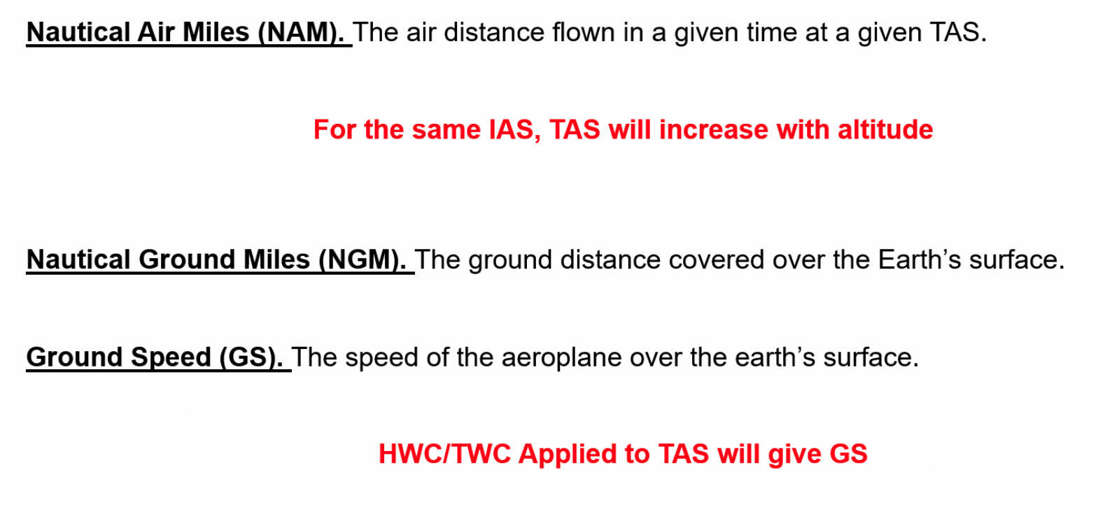

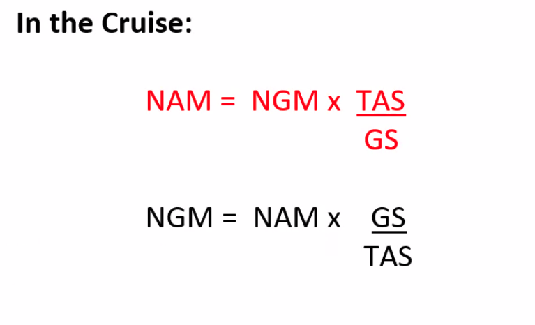
"In 'Nam, they required ground support on the ground" - GS on the bottom for NAM
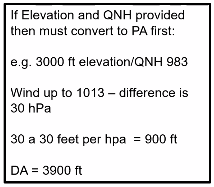
==Q. Pressure Alt 5500ft, QNH 998hPa, OAT +30C. Calculate the Density Altitude== A. 8620ft AMSL
ISA temp at 5500ft = +15X - (2C x 5.5) = +4C in standard ISA
OAT is +30C, deviation is 26C
Altitude correction is 120ft per 1deg of ISA dev, so. 120 x 26 = 3120ft
5500 + 2130 = 8620ft AMSL